

1929 aerial photos of УлшжжБВЅ
Aerial photographs of УлшжжБВЅ takenТ Feb. 14, 1929.
Did you know? We have a throwback email newsletter т snapshots of УлшжжБВЅ history sent to your inbox every Thursday! Sign up:Т
1929 Aerials of УлшжжБВЅ

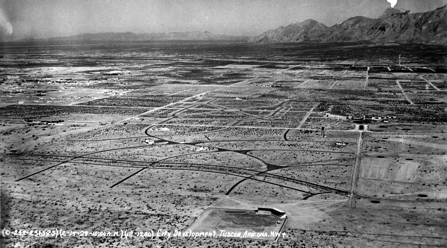
The campus of the University of УлшжжБВЅ with the football field directly west of Bear Down gym. On February 14, 1929 an unknown photographer and or pilot took aerial pictures of the УлшжжБВЅ area with the first known photograph taken around 9:50 am and the last around 11:40 am. Take note of the barren landscape that makes up most of the УлшжжБВЅ valley.
1929 Aerials of УлшжжБВЅ
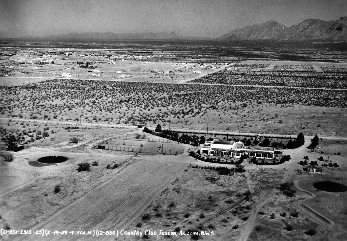
The УлшжжБВЅ Golf and Country Club was located on East Broadway Boulevard and North Country Club. It had a gravel course, no grass, with greens made with oiled sand. On February 14, 1929 an unknown photographer and or pilot took aerial pictures of the УлшжжБВЅ area with the first known photograph taken around 9:50 am and the last around 11:40 am. Take note of the barren landscape that makes up most of the УлшжжБВЅ valley.
1929 Aerials of УлшжжБВЅ
From this view, Hi Corbett Field, bottom, can be seen with the newly developed Colonia Solana and El Encanto Estates to the north. To the east of El Encanto is the El Conquistador Hotel and its water tower across the street. To the west on the edge of the photo is the УлшжжБВЅ Golf and Country Club. On February 14, 1929 an unknown photographer and or pilot took aerial pictures of the УлшжжБВЅ area with the first known photograph taken around 9:50 am and the last around 11:40 am. Take note of the barren landscape that makes up most of the УлшжжБВЅ valley.
1929 Aerials of УлшжжБВЅ

In 1922 the University of УлшжжБВЅ Polo Team was created as part of the ROTC program. It was the first UA athletic team to be invited to a national championship in 1924 but lost to Princeton. The field, which was located north of East Speedway and west of North Campbell Avenue, made way for the medical school. On February 14, 1929 an unknown photographer and or pilot took aerial pictures of the УлшжжБВЅ area with the first known photograph taken around 9:50 am and the last around 11:40 am. Take note of the barren landscape that makes up most of the УлшжжБВЅ valley.
1929 Aerials of УлшжжБВЅ
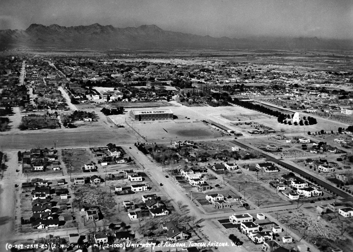
The eastern edge of the University of УлшжжБВЅ clearly shows Bear Down Gym, middle, and the tree-encircled Steward Observatory, right. On February 14, 1929 an unknown photographer and or pilot took aerial pictures of the УлшжжБВЅ area with the first known photograph taken around 9:50 am and the last around 11:40 am. Take note of the barren landscape that makes up most of the УлшжжБВЅ valley.
1929 Aerials of УлшжжБВЅ

At one time the once-gracious El Conquistador Hotel offered 70-rooms with private baths, lawns in the front and back, palm trees, 350 varieties of roses all for $9 a day for a single, meals included. Years after the photo was taken a stable with 50 horses was added along with a pool, tennis and shuffleboard courts. After 1959 it gradually made way for the El Con Mall. On February 14, 1929 an unknown photographer and or pilot took aerial pictures of the УлшжжБВЅ area with the first known photograph taken around 9:50 am and the last around 11:40 am. Take note of the barren landscape that makes up most of the УлшжжБВЅ valley.
1929 Aerials of УлшжжБВЅ

The brand new VA Hospital, which opened on August 18, 1928, was built on 117 acres of donated land along South Sixth Avenue north of Ajo Way. It was meant to house World War I veterans suffering from tuberculosis. The architect, Roy Place, had also designed the Pima County Courthouse. And yes, it has always been pink. On February 14, 1929 an unknown photographer and or pilot took aerial pictures of the УлшжжБВЅ area with the first known photograph taken around 9:50 am and the last around 11:40 am. Take note of the barren landscape that makes up most of the УлшжжБВЅ valley.

Rick Wiley
Photo editor
19 photos of horse racing in УлшжжБВЅ, dating back to 1940s.

Country music superstars Waylon Jennings and Willie Nelson at their peak together in September, 1976 at the УлшжжБВЅ Community Center.

75 years ago, the Japanese attack on Pearl Harbor, Hawaii, brought the U.S. into World War II. In his address asking Congress for a declaratio…

Using these marks you as УлшжжБВЅan for life, and it's УлшжжБВЅan, not УлшжжБВЅian.

Feel nostalgic for some УлшжжБВЅ institutions that are gone forever.

Do you know the elevations of major landmarks in УлшжжБВЅ?

On the restaurant's website patrons are told to, "relax and enjoy yourself" and "feel the love"

Nearly 40-percent of Old УлшжжБВЅ Studios, including many of the most-famous wood structures seen in Westerns, was destroyed by fire on April 24, 1995.

Who remembers when the Tanque Verde Swap Meet was on Tanque Verde?