Pima County contractors will start removing trees and sediment from a stretch of the Santa Cruz River north of downtown this week in the name of flood protection and public safety.
Work crews and construction equipment will be out on the river for the two-month, $860,000 effort. Authorities will try to balance flood and habitat protection, under the wary eyes of neighborhood and environmental activists.
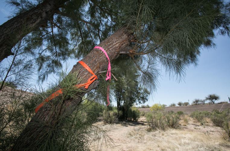
The work will remove 30.4 acres of native mesquite and palo verde and non-native tamarisk trees from the river from Grant Road to Speedway.
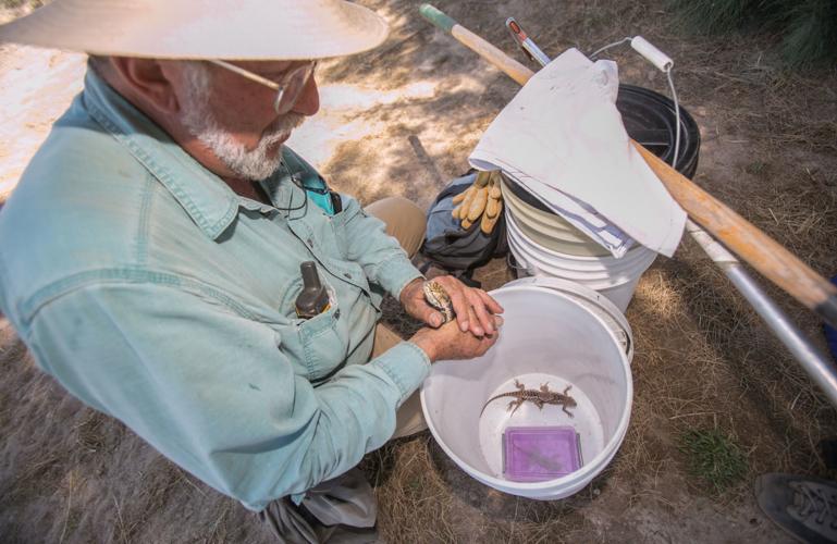
Another 5.8 acres, containing all but one of 23 active bird nests in the area, will be preserved, said Eric Shepp, deputy director of the Pima County Regional Flood Control District. Some wildlife, including lizards and burrowing owls, is being relocated. Crews will also remove an estimated 110,000 cubic yards of sediment, enough to cover almost 200 football fields 3 inches deep.
People are also reading…
The soil removal will protect 45 of 51 homes, businesses and other buildings lying in the flood plain along the 1.4-mile stretch from Grant to Speedway, county officials say.
This is the first of three major vegetation- and soil-removal projects the county will be doing along the river in and near downtown over the next couple of years for flood control. County officials say the sediment and vegetation have raised the riverbed and the accompanying flood risk since the 1980s. The problem is that the elevated riverbed no longer can carry as much floodwater as it used to without overtopping the banks.
The entire stretch of river to be tackled in this work, from 29th Street to Grant, contains 173 structures valued at $84 million, in 4 miles of flood plain, says a new county report on the Santa Cruz.
County officials hope to start on the second stretch of soil and vegetation removal between 29th and Mission Lane in late fall 2018 or early 2019. The most complex stretch of the overall project will be the section through downtown from Mission to Speedway, containing lots of vegetation and intense development on the riverbanks. It hasnŌĆÖt been scheduled yet and is likely to be very controversial because of the large amount of development there already.
Both of the later phases will require city approval because the city owns the riverbed south of Speedway. The county can do the current project without city approval because it owns the riverbed from Speedway to Grant.
For environmentalists and neighborhood activists, the Grant-Speedway project is fraught with controversy over its substance, timing and how county officials communicated their plans to the public.
A leading local environmentalist, Christina McVie, says the county didnŌĆÖt get public input in a timely manner. County officials held a public open house on the project only on April 19, four days before the workŌĆÖs original start date. Then, they pushed construction back a week after neighbors complained the open house was a farce because of its timing.
But McVie acknowledged that the work is necessary and said the county is doing a good job of trying to balance public safety and preservation.
ŌĆ£They have no option. They analyzed a series of four alternatives, and chose an alternative that allows them to achieve a high percentage of their goals, while still trying to maintain some vegetation in the channel,ŌĆØ said McVie, who represents the ├█Ķųų▒▓ź Audubon Society on the Community Water Coalition, an activist group on local water issues.
ŌĆ£In an ideal world, the habitat loss would be my major issue. But this is not an ideal world. I am a pragmatist.ŌĆØ
Others, however, say the project is a ŌĆ£Band-AidŌĆØ and ŌĆ£piecemealŌĆØ effort that wonŌĆÖt address the root causes of the riverŌĆÖs chronic flooding issues. TheyŌĆÖre concerned the work will have to be repeated in a few years or a decade, as the sediment builds up again. They say more comprehensive solutions are needed.
TheyŌĆÖre also concerned the project will damage a rich bird habitat and arenŌĆÖt happy that the work is being done during nesting season.
In the neighboring river stretch between Speedway and Congress Street, 116 bird species have been recorded since 2004 on the eBird website maintained by Cornell UniversityŌĆÖs Laboratory of Ornithology. One was a threatened yellow-billed cuckoo, seen on the river in 2007.
About 125 bird species have been recorded near the U.S. Fish and Wildlife ServiceŌĆÖs ├█Ķųų▒▓ź office, lying near the river between St. MaryŌĆÖs Road and Congress Street.
Long-term solution called for
One critic is Tom Collazo, a 40-year resident of neighboring Barrio Hollywood and a retired Nature Conservancy official who says he walks that stretch of river virtually every day.
He said he appreciates the countyŌĆÖs problems in the area. At the same time, the countyŌĆÖs land conservation plans say all riparian areas are important and that their owners should maintain them, he said.
He and others noted that county officials have made a big deal of their success at restoring the Lower Santa Cruz, downstream of the two county sewage-treatment plants that send heavily treated wastewater into the river. Collazo and others would like to see a major restoration of the natural riparian habitat.
Now that climate change is poised to change rainfall patterns and trigger more severe storms, it may be time for the county and city governments to sit down and talk about a long-term solution for the entire river through ├█Ķųų▒▓źŌĆÖs heart, Collazo said: ŌĆ£The planning has been segmented until now. IŌĆÖm not trying to point fingers at anyone. ItŌĆÖs a collective situation. ItŌĆÖs hard to address.ŌĆØ
Diana Hadley, a longtime west-side activist and a historian, and Eric Holler, a retired engineer, said one long-term solution could be to build retention basins to hold back some of the floodwaters on the Santa Cruz and its tributaries, to reduce flooding through the downtown area. If thatŌĆÖs done over 20 to 30 sub-watersheds in the entire Santa Cruz Basin, that could make a big difference, ŌĆ£but itŌĆÖs not going to be easy and itŌĆÖs not going to be quick,ŌĆØ Holler said.
Many people would like to see an effort to revegetate the river through downtown with riparian habitat, to make it a public attraction and to provide shade, said Hadley, a former Menlo Park Neighborhood Association president.
ŌĆ£We donŌĆÖt want to be sitting here 30 years from now saying, ŌĆśBoy, if we would have done this right, it would have been much better than now,ŌĆÖŌĆØ said Holler, who worked many years for the U.S. Bureau of Reclamation.
Development on
river banks
As the countyŌĆÖs Shepp sees it, the river and its soil-cement banks are like any piece of infrastructure: They need maintenance. City and county officials made a basic decision decades ago to line the river from 29th Street through downtown with the cement banks. That turned a dry riverbed into a river channel.
Since then, local governments, particularly ├█Ķųų▒▓ź, have made land-use decisions allowing development near the banks that needs flood protection, he said.
Trying to make this a natural channel now is like trying to close the barn door after the horse is gone, said County Administrator Chuck Huckelberry.
ŌĆ£WeŌĆÖd love to have a natural channel, but we donŌĆÖt have one. ItŌĆÖs been decades of urban encroachment there. We have to face the fact that periodically we will have to remove sediment,ŌĆØ he said.
The city and county started lining the river with soil cement south of Speedway near downtown in 1982. A year later, the cityŌĆÖs record-setting flood of 1983 sent 52,700 cubic feet per second of water down the river through downtown. At that time, floodwaters overtopping the river bank reached Interstate 10 at depths of about 2 feet, says the new county report.
The cement lining went into the other two river segments after the 1983 flood, with the Grant-Speedway section completed in 1991. Those sections were designed to handle whatŌĆÖs now considered the riverŌĆÖs 100-year flood of 60,000 cubic feet per second. The downtown stretch was designed for only 30,000 cfs.
Partly because the cement lining has prevented sediment from spreading outside the river banks, the river channel has risen as much as 10 feet over 30 years. The channel has not been cleared in that time.
Since the Santa CruzŌĆÖs last big flood in 1993, the riverŌĆÖs capacity to carry water through downtown has been slashed by two-thirds, the county reports. Even a minor flood of barely 13,000 cfs in September 2014 forced the city to close bridges in the area.
If the river sediment and vegetation arenŌĆÖt removed, this entire area would have to be formally designated a new, Special Flood Hazard Area, the county report says. Federal flood insurance rate maps would have to be revised, meaning residents and businesses would be required to buy flood insurance if they have a federally guaranteed mortgage.
At the same time, even if the sediment were removed, ŌĆ£in all casesŌĆØ the bridges at Congress Street, St. MaryŌĆÖs Road and Speedway would be overtopped during a 100-year flood, the report says. That could cut off thousands of west-side residents from the rest of the city.
The only bridge between 29th and Speedway designed to handle a 100-year flood is the Cushing Street bridge, built this decade.
Huckelberry said it could cost $5 million a bridge or more to upgrade them to handle a 100-year flood. He hopes that planning and other design work on bridge upgrades could begin in no more than two years. With Rio Nuevo developing fast, ŌĆ£ItŌĆÖs something we need to address in the near term, in cooperation with the city,ŌĆØ he said.
ŌĆśCommunication was botchedŌĆÖ
Neighborhood and environmental concern about the impacts of the flood control work has also been building.
It started in 2016, after the county cleared virtually every tree and shrub for a similar flood protection project on the Rillito River from Alvernon Way to halfway between Columbus and Swan roads. At that time, the ├█Ķųų▒▓ź Audubon Society raised concerns that an important ŌĆ£weed patchŌĆØ where birds flock along the river was cleared, with no advance notice to them. It was later restored. Neighbors also said they didnŌĆÖt get enough chance to respond.
This time around, the county started working on planning for this project in early 2017, in hopes of starting work before bird-nesting season began. But the work was delayed while county officials tried to gain the cityŌĆÖs approval for the other two phases of the project, Shepp said.
After it became clear by March that this approval would take a while, the county decided to start work about now to get it done in time for the upcoming monsoon season.
As for informing the community, county officials thought they had established open lines of communication with ├█Ķųų▒▓ź Audubon and the Community Water Coalition, Shepp said.
But that didnŌĆÖt happen, and at a meeting with neighbors and activists last week, ŌĆ£We were all in agreement that communication was botched,ŌĆØ Shepp said. The county will try to prevent this from happening again, he said.
To mitigate the new projectŌĆÖs impacts on the river, the County Flood Control District plans to create a new ŌĆ£water harvesting basinŌĆØ in an area north of Grant Road and the cityŌĆÖs existing Juhan Park, just north of Grant and west of the river.
Workers will dump the river sediment into an existing 15-foot-deep hole, 6 acres in size, in the riverbed. That will leave a 2-foot depression in the hole to catch rainwater diverted from nearby areas. The rainwater will cause native plants to grow there.
The county will also relocate burrowing owls living in three nests in the Juhan Park area to the Wild at Heart wildlife rescue and rehabilitation center in Casa Grande, then permanently relocate them to another spot, perhaps along the Santa Cruz south of 29th where many native trees were planted in recent years. The relocation will start once the county obtains a pending federal permit.
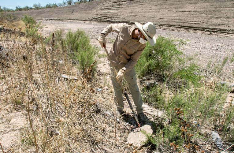
Biologists working as consultants for the county spent much of last week combing the riverbed for snakes, lizards and rodents and moving them from harmŌĆÖs way.
Phil Rosen, a longtime lizard specialist and ecologist, and biologists for the private Harris Environmental Group have removed 50 to 75 lizards representing at least a half-dozen species, as well as two diamondback rattlesnakes and some wood and cotton rats. TheyŌĆÖll be relocated to more wildlife-friendly washes such as the Alamo, the Arroyo Chico and perhaps the Santa Cruz south of 29th Street.
ŌĆ£I donŌĆÖt like it, but thereŌĆÖs millions of dollars of property involvedŌĆØ that needs the flood-control protection, Rosen said. ŌĆ£They know what theyŌĆÖre doing.ŌĆØ


