

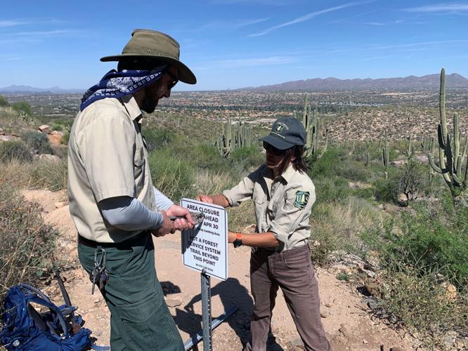
About 54 miles of new trails could be added to the existing 240-mile trail system in the Santa Catalina Mountains north of УлшжжБВЅ under a plan finalized Friday, officials say.
The Santa Catalina Trail Plan envisions the expansion over the next 15 years through adoption and new trail construction.
But it also would drop about 31 miles of trail from Forest Service maintenance. Most are on the northwest side of the mountain range severely burned in the 2020 Bighorn Fire as well as rarely-used trails on the east side of the range, the final plan shows.
The plan is result of a two-year public process that began shortly after the Bighorn Fire burned the entire range and damaged 70 percent of the trail system.
People are also reading…
The plan is a joint effort by staff on the Santa Catalina Ranger District, the parent Coronado National Forest headquartered in УлшжжБВЅ and a number of partner and volunteer groups.
The work is only starting. Environmental analysis and/or planning has begun for several trail adoptions, connectors, reroutes, trailhead improvements and a new climbing area. New trail projects would be evaluated and implemented between 2025-2030.
The current system has many steep trails with little connection, inadequate parking and safety issues at trailheads. This first-ever holistic plan aims to address skyrocketing winter trail use; growth in new uses like mountain biking and climbing; and need for gentle trails for equestrians and beginning hikers and cyclists.
Features in the final are similar to those in draft plan released in November 2022, but there are a few significant adjustments based on feedback over the past seven months.
Some 18 miles of user-created, or тunauthorized,т trails between Golder Ranch Road and Catalina State Park in the western Catalina foothills т had the most popular support for adoption, said Adam Milnor, recreation staff officer on Coronado National Forest.
Although some public comments said the higher reaches of Mount Lemmon are really important and significant, тwe forgot how important the lower elevations on the Sonora Desert are to so many users,т Milnor said. тPeople are using the skirt of this mountain range, itтs extremely significant to people.т
The Forest Service will seek an easement or right of way to state lands heavily used by cyclists and equestrians along the 7.6-mile т50 Year Trail,т which is protected by a 50-year lease agreement between УлшжжБВЅ State Parks and Trails and УлшжжБВЅ State Land Department which expires in 2038. That land could be sold for private development after the lease expires.
Working groups of equestrian and mountain bikers helped design plans for a 16-mile trail system to avoid archeological sites, reroute around steep wash crossings and offer new connectors.
Milagrosa, a popular 3.75-mile mountain bike route that connects private and Pima County land to the УлшжжБВЅ Trail east of Molino Basin, is also up for тadoption,т along with a trail that links the Sabino Canyon overflow parking lot to the Esperero Trail and some smaller trail segments.
New connectors and projects
Phase 1 of the plan offers lower-elevation connector trails and projects for environmental analysis this summer and fall. Construction could start as soon as October. This includes:
A 1.9-mile trail connecting Finger Rock and Pantatoc trails in the Catalina foothills;
A one-mile trail in lower Molino Canyon for mellow hiking;
Planning for Molino Canyon parking expansion and reconfiguration of Gordon Hirabayashi campground to separate day use parking from campground use and offer horse trailer parking.
The Crags Against Humanity т popular climbing area right off highway with improved trail access, belay terraces and kiosk/sign on climbing safety and etiquette.
Environmental work has already been done on a project for improved Marshall Gulch parking and access and also on new trailheads, parking and additional trails for the Tanque Verde Falls area off Reddington Road. So these projects may start construction earlier, Milnor said.
New trails for the future
New multi-use, downhill cycling, accessible and connector trails, or rerouted trails are envisioned for the near future. Many are in habitat for Mexican spotted owl, a threatened species, requiring consultation with the U.S. Fish and Wildlife Service. Most were proposed in the draft plan. Big trail projects include:
Vista Trail, 8.5-mile gentle multi-use trail linking Rose Canyon to trailheads along the Santa Catalina Highway and the Sunset Trail to Marshall Gulch near Summerhaven. УлшжжБВЅ Trail Association, which maintains the УлшжжБВЅ Trail, supports Vista as a safe alternative for equestrian and non-expert mountain bikers.
тBug Junior,т a six-mile downhill-only (тdirectionalт) advanced mountain bike route paralleling the existing Bug Spring Trail. Also proposed is a 1.4-mile downhill Fireline Trail on north slope of Mount Bigelow for intermediate cyclists.
A short paved accessible Mount Lemmon Interpretive Trail.
A variety of connector routes including Marshall Gulch to Summerhaven and a hiker trail in the Rose Canyon recreation area.
A new proposed trail emerging from user discussions is the 4.5-mile Knagge to Davis Spring Loop connector trail. It would connect the Butterfly and Knagge trails on east side. The Friends of Santa Catalina Trails Association will seek grant funding for the project, Milnor said.
New trail construction is not a given.
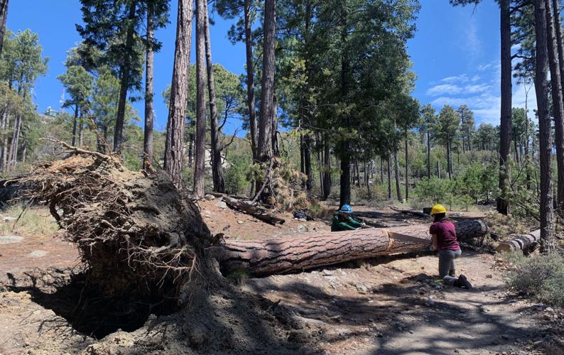
So far, the Forest Service has pieced together funding and grants from the National Forest Foundation for restoration work in the Bighorn Fire area along with other funding and volunteer help to rebuild trail sections in the Catalinas.
Trails off the table
Saddest news for hikers involves trails on the northwest end of the Catalinas that were most heavily damaged by the Bighorn Fire. Currently, the Sutherland and Canada del Oro trails would be dropped from official maintenance along with Samaniego Trail from Peak 7494 to Charouleau Gap.
тWe originally proposed to restore Samaniego but heard from multiple users that the trail would be difficult to maintain as it has heavy chaparral vegetation that requires frequent brushing. So, we will maintain it up to a nice viewpoint but let the rest go away,т Milnor said. Canada del Oro Trail also is not viable, he said.
For northern access, the Red Ridge Trail from Mount Lemmon to Catalina Camp will be improved with a connecting trail to Charouleau Gap. Red Ridge is also preferred new route for a section of the УлшжжБВЅ Trail which could be rerouted from Oracle Ridge at Rice Peak.
Also on the cutting block are Lower Brush Corral, Evans Mountain, Lower Davis Spring and lower Knagge trails. The proposed Knagge-Davis Spring trail would offer a 10-mile loop option for hikers while lesser-used trails in this area would no longer be maintained.
Milnor noted that trails off the system will not be closed to users but are not considered feasible to maintain. тThe decision to remove some trails was driven by our overall 10 percent growth target and wanting to spend out limited resources on sustainable trails that can be accessed and used by more people rather than remote, wildfire-impacted trails.т
Back by popular demand
The six-mile Box Camp Trail from the Catalina Highway to East Fork Sabino, initially proposed to be dropped, will stay in the trail system due to trail users support and offers of maintenance help, Milnor said.
A cultural resource history on the trail indicated it is most likely a route to the high country used by ancestral Apache or even earlier Native people, he said. тRoyal Kellogg, who was sent by (first Forest Chief) Gifford Pinchot to survey the Catalinas for potential inclusion as a forest reserve describes being guided on that trail back in 1902.т
It also was likely used by packers for access before the Oracle Control Road, the first access road to top of Catalinas, was built.
Photos: Rancho Romero and the establishment of Catalina State Park

Rancho Romero (now Catalina State Park) in November, 1973. Gov. Jack Williams signed legislation in May, 1974, authorizing the state to acquire more than 13,000 acres in Pima and Pinal counties to help establish a new state park.

The site of the home on Rancho Romero. Original photo ran in the УлшжжБВЅ Citizen Around Your Home section July 4, 1964.

Rancho Romero, home of Mr. and Mrs. J.E. McAdams. Photo originally ran in the УлшжжБВЅ Citizen Around Your Home section April 19, 1958.

Views from Rancho Romero are spectacular in every direction. Photo originally ran in the УлшжжБВЅ Citizen Around Your Home section April 19, 1958.

An overhang of redwood slats shades the inner entry court to the home of the William C. Jordans on Rancho Romero. Thus interesting sun patterns are cast through the partly open overhang. Outside construction of the home is of burnt adobe. Original photo ran in the УлшжжБВЅ Citizen Around Your Home section July 4, 1964.

The УлшжжБВЅ-Florence Highway (Oracle Road) lower right, and Rancho Romero, center of the photo, alongside the CaУБada del Oro Wash in 1973. Further on, the CDO intersects with the Sutherland Wash in what is now Catalina State Park.

Rancho Romero (now Catalina State Park) in November, 1973. Gov. Jack Williams signed legislation in May, 1974, authorizing the state to acquire more than 13,000 acres in Pima and Pinal counties to help establish a new state park.

Rancho Romero (now Catalina State Park) in November, 1973. Gov. Jack Williams signed legislation in May, 1974, authorizing the state to acquire more than 13,000 acres in Pima and Pinal counties to help establish a new state park.

Rancho Romero (now Catalina State Park) in November, 1973. Gov. Jack Williams signed legislation in May, 1974, authorizing the state to acquire more than 13,000 acres in Pima and Pinal counties to help establish a new state park.

Rancho Romero (now Catalina State Park) in November, 1973. Gov. Jack Williams signed legislation in May, 1974, authorizing the state to acquire more than 13,000 acres in Pima and Pinal counties to help establish a new state park.

Rancho Romero (now Catalina State Park) in November, 1973. Gov. Jack Williams signed legislation in May, 1974, authorizing the state to acquire more than 13,000 acres in Pima and Pinal counties to help establish a new state park.

Rancho Romero (now Catalina State Park) in November, 1973. Gov. Jack Williams signed legislation in May, 1974, authorizing the state to acquire more than 13,000 acres in Pima and Pinal counties to help establish a new state park.

Rancho Romero (now Catalina State Park) in November, 1973. Gov. Jack Williams signed legislation in May, 1974, authorizing the state to acquire more than 13,000 acres in Pima and Pinal counties to help establish a new state park.

Rancho Romero (now Catalina State Park) in May, 1973. Gov. Jack Williams signed legislation in May, 1974, authorizing the state to acquire more than 13,000 acres in Pima and Pinal counties to help establish a new state park.

Rancho Romero (now Catalina State Park) in May, 1973. Gov. Jack Williams signed legislation in May, 1974, authorizing the state to acquire more than 13,000 acres in Pima and Pinal counties to help establish a new state park.

Rancho Romero (now Catalina State Park) in May, 1973. Gov. Jack Williams signed legislation in May, 1974, authorizing the state to acquire more than 13,000 acres in Pima and Pinal counties to help establish a new state park.

Rancho Romero (now Catalina State Park) in May, 1973. Gov. Jack Williams signed legislation in May, 1974, authorizing the state to acquire more than 13,000 acres in Pima and Pinal counties to help establish a new state park.

Rancho Romero (now Catalina State Park) in May, 1973. Gov. Jack Williams signed legislation in May, 1974, authorizing the state to acquire more than 13,000 acres in Pima and Pinal counties to help establish a new state park.

Rancho Romero (now Catalina State Park) in August, 1973. Gov. Jack Williams signed legislation in May, 1974, authorizing the state to acquire more than 13,000 acres in Pima and Pinal counties to help establish a new state park.

Rancho Romero (now Catalina State Park) in August, 1973. Gov. Jack Williams signed legislation in May, 1974, authorizing the state to acquire more than 13,000 acres in Pima and Pinal counties to help establish a new state park.

Rancho Romero (now Catalina State Park) in August, 1973. Gov. Jack Williams signed legislation in May, 1974, authorizing the state to acquire more than 13,000 acres in Pima and Pinal counties to help establish a new state park.

Rancho Romero (now Catalina State Park) in August, 1973. Gov. Jack Williams signed legislation in May, 1974, authorizing the state to acquire more than 13,000 acres in Pima and Pinal counties to help establish a new state park.

Wayne and Dianne Allen of Austin, Texas, retired for six months, sit under a tree in their camping spot at Catalina State Park on Tuesday, April 30, 2013 in УлшжжБВЅ, AZ. The couple are on an extended vacation heading to Utah and Denver to see their kids. They were preparing a vegetable dish in a gas oven, foreground, they just bought and put on the grill outside.

Late afternoon sun peaks through the leaves of a tree as a catus stands in the background at Catalina State Park on Tuesday, April 30, 2013.

A view of the Catalina Mountains looking east just after sunrise at Catalina State Park on Wednesday, May 1, 2013.
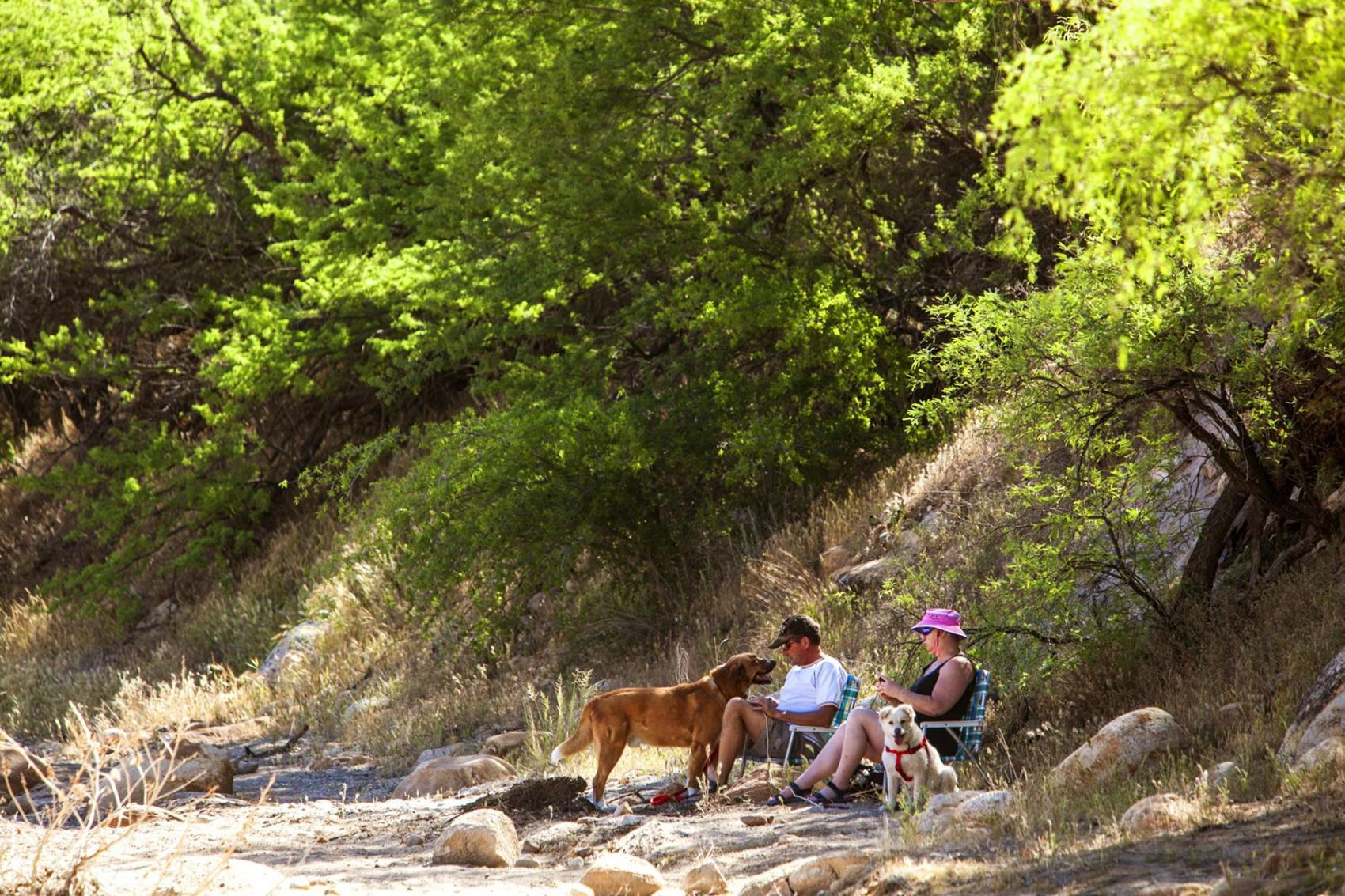
John and Kathy Mulligan from УлшжжБВЅ sit with their dogs Max, left, and Wiley in the Canyon del Oro Wash at Catalina State Park on Wednesday, May 1, 2013 in УлшжжБВЅ, AZ. They were having lunch prior to taking a hike on the Canyon Loop Trail.

Poppies along the Sutherland Trail at Catalina State Park on Feb. 23, 2012.

Horseback riders on the Canyon Loop Trail at Catalina State Park in УлшжжБВЅ, Ariz., on Feb. 15, 2103.

УлшжжБВЅ hikers Kevin Duckett and his wife Melanie Duckett look at stone ruins along the Romero Ruin Interpretive Trail at Catalina State Park.

The Santa Catalina Mountains from the Romero Ruin Interpretive Trail at Catalina State Park in УлшжжБВЅ, Ariz., on Feb. 15, 2103.

Saddlebrooke resident Seth Basker and his son Jonathan walk past a Desert Willow that has been dedicated to Steve Schulman inside Catalina State Park on Friday, November 25, 2011, in Oro Valley, Ariz. The park is starting a Tree Dedication Program where a native tree is planted there in celebration of a loved one, a newborn, an anniversary or for any occasion.

Jill Wheatley enjoys the view from a hill along the Romero Ruins Trail in Catalina State Park with the Santa Catalina Mountains in the background and their dusting of snow from a morning storm, Thursday, Dec. 30, 2010.

Park ranger Courtney Nault, right, leads the way up a stair climb as about 20 hikers take part in the Romero Ruins Adventure Hike at Catalina State Park, 11570 N. Oracle Road, on Wednesday, Jan. 1, 2014, in Oro Valley, Ariz. The hike was one of several featured as part of Jan.1 First Day Hikes in state parks across the country.

From right, Levi Milton, 13, Beth Busse, Pierce Burns and Simon Burns, 8, enjoy a New Yearтs Day trek on the Romero Trail in Catalina State Park. A winter storm brought snow to the upper elevations as well as the metro area on New Yearтs Eve into New Yearтs Day in УлшжжБВЅ on Jan. 1, 2015, in УлшжжБВЅ, Ariz.

Grasses bring a cloak of green to a woodland at Catalina State Park north of УлшжжБВЅ.

Sutherland Wash in Catalina State Park is flowing fast with snowmelt from the Catalina Mountains.
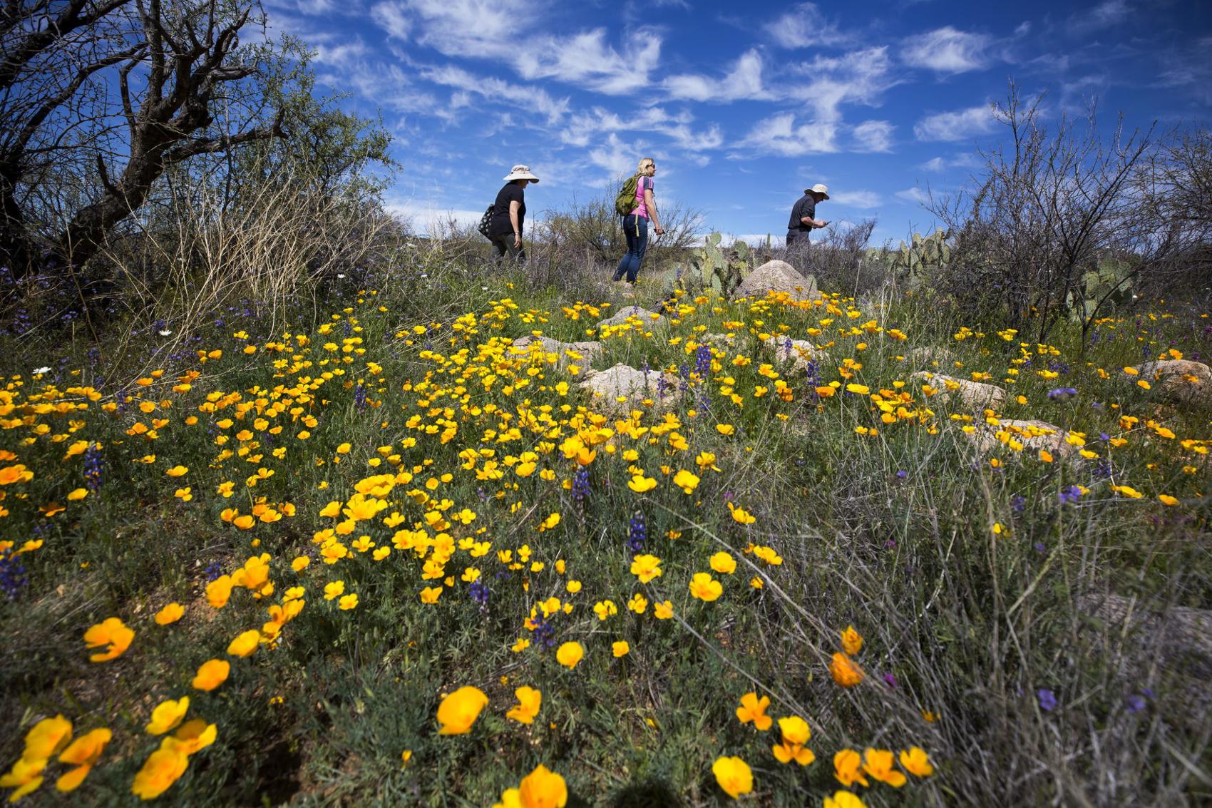
From left to right, Gabriella Porreca, Edita Navratilova and Frank Porreca hike past a bed of Mexican and California Gold Poppies on the Sutherland Trail in Catalina State Park, 11570 N. Oracle Rd., in Oro Valley, Ariz., on March 10, 2020.

Edita Navratilova, right, takes pictures of a group of Mexican and California Gold Poppies on the Sutherland Trail in Catalina State Park, 11570 N. Oracle Rd., in Oro Valley, Ariz., on March 10, 2020.

A group of Purple Owl's Clover stand out in front of a bed Gold Poppies on the Sutherland Trail in Catalina State Park, 11570 N. Oracle Rd., in Oro Valley, Ariz., on March 10, 2020.

The historic ruins of Francisco Romero's mid-1800s ranch at Catalina State Park.

Jose Lazarini, right, shows wife Maria the proper drawback technique on an archery bow during an УлшжжБВЅ State Parks' Family Campout Program on Saturday, April 18, 2015, at Catalina State Park, 11570 N. Oracle Road, in Oro Valley, Ariz. The Lazarinis, who came with their two children from Cave Creek, are on their first campout ever. During the overnight campout, families are helped with proper tent set-up, propane stove cooking and some outdoor fun with nature hikes, archery and slingshots.

Jose Lazarini, center left, poses questions as he leads a fun game of Family Feud with (from left) Jet McMurrary, 10, children Gilma, 6, and Jose Jr., 7, and Leah Sweatman, 9, during an УлшжжБВЅ State Parks' Family Campout Program on Saturday, April 18, 2015, at Catalina State Park, 11570 N. Oracle Road, in Oro Valley, Ariz. During the overnight campout, families are helped with proper tent set-up, propane stove cooking and some outdoor fun with nature hikes, archery and slingshots.

Pulitzer Prize winning photographer and Oro Valley resident Jack Dykinga photographs a flower grouping at Catalina State Park north of УлшжжБВЅ, AZ. Dykinga, who shoots for National Geographic and УлшжжБВЅ Highways, among others, has had an artistic re-birth he says, since a life saving lung transplant.

From left, Suzanna Schleck hikes with son Drew, right, and his girlfriend Amy Fritz along the 50-Year Trail in Catalina State Park, 11570 N. Oracle Road, northwest of УлшжжБВЅ, Ariz. Their family, scattered throughout the country, all met up for a sightseeing Christmas holiday in УлшжжБВЅ. УлшжжБВЅ State Parks is offering a series of guided "First Day Hikes" on New Year's Day. Photo taken at her home on Thursday, Dec. 24, 2015.

Watch now: Sweetwater Preserve is home to 15 trails and more than 880 acres of desert beauty.


