About 20 miles of trails т closed for more than a year due to damage from the 2020 Bighorn Fire т have reopened in the Santa Catalina mountains north of УлшжжБВЅ.
After Bighorn burned almost 120,000 acres between June 5 and July 23, 2020, the Forest Service closed the burn scar area to the public including almost 207 miles of trails. A combination of nonprofit group work, grant-funded conservation corps, and Forest Service staff work has steadily opened more trail sections over the past year.
The newest тclosure orderт issued Dec. 15 by the Coronado National Forest, actually opens most of the popular УлшжжБВЅ Trail Wilderness Bypass mountain bike trail system including Butterfly and the rest of Green Mountain Trail. Of that system, only Crystal Springs Trail remains closed; although volunteers and crews have been working on this trail, which should be usable soon. Brush Corral Trail, connecting Green Mountain Trail to the Redington Pass area, also is open.
People are also reading…
Also newly reopened are more miles on Pima Canyon, Finger Rock and Esperero trails in the Pusch Ridge Wilderness. One could now hike Ventana Canyon all the way to the тwindowт and continue to the top of Esperero Canyon.
Of the 225 miles of designated trail on the Santa Catalina Ranger District, more than 50 miles remain closed. For specific trails still closed see тSanta Catalina Ranger District Mt. Lemmon Bighorn Fire Closureт on the Coronado National Forest website (at ).
Major ridge trails such as Samaniego, Sutherland and Canada del Oro remain closed although Red Ridge Trail, popular with mountain bikes, is open thanks to work from УлшжжБВЅ Off-Road Cycling Association (TORCA). TORCA has also done and obtained grant funding for work to reopen Green Mountain Trail including heavy rock reconstruction work to stabilize drainage crossings.
Priorities for reopening include Mount Lemmon and Esperero trails, said Adam Milnor, recreation staff officer for the Coronado National Forest. Other trails such as Romero Canyon above Romero Pools, which remains closed, would require totally rebuilding miles of washed-out gullies. It costs about $10,000 per mile to reestablish higher elevation trails, Milnor added.
The Forest Service was initially concerned about burned dead trees that might fall (тhazard treesт) and trails that could severely wash out in steep rocky terrain where stabilizing vegetation had burned off. Many hazard trees were removed, and a dry 2020 winter and spring did not produce flooding. However, this summerтs monsoon rains resulted in washouts and trail damage.
тThe main hazard now is eroded hill slopes with little or no treadт such as side slope trails on upper Pima and Finger Rock canyons, said Charles тCJт Woodward, Catalina district ranger. тThese are highly erosive soils, and we have to completely rebuild the trails.т

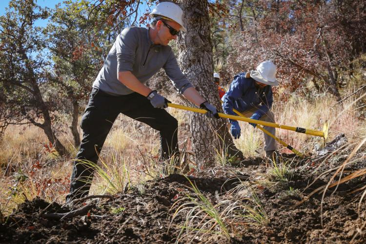
The Green Mountain Trail in the Santa Catalina Mountains has been getting extra maintenance since the Bighorn Fire in 2020.
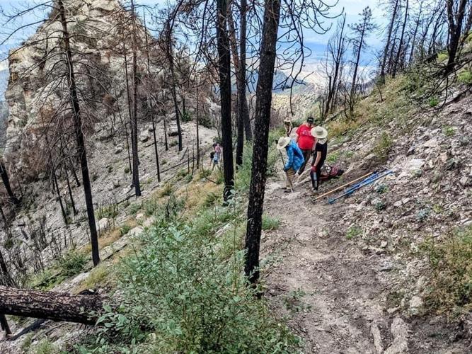
Volunteer cleanup events work well on accessible trails like the first miles of canyon trails or trails right off Mount Lemmon Highway. Trails far out in backcountry like Cathedral Rock and Samaniego are a logistical challenge, according to Milnor. The area has little water, and it is difficult to support a crew on a ridge trail for several days.
Last March, major sections of УлшжжБВЅ Trail through the Catalinas were reopened: 18.5-mile Passage 11a, including West Fork Sabino and Wilderness of Rocks Trail, and 15.5-mile Passage 12 Oracle Ridge Trail. Before reopening, УлшжжБВЅ Trail Association volunteers documented all hazardous trees in the burn; an УлшжжБВЅ Conservation Corps (AZCC) crew hired by the Forest Service and certified sawyer volunteers cleared hazards so the trail could reopen for the 2021 thru-hiking season. Several volunteer events also helped restore parts of these trails.
Community affair
Trail rework has been a public-government effort. The Forest Service has invested about $100,000 to fund AZCC crews on Ventana, Butterfly, Green Mountain, Wilderness of Rocks and West Fork Sabino trails. TORCA secured grants for two more weeks of AZCC work on Green Mountain. Another AZCC crew worked on Crystal Springs.
National Forest Foundationтs Southern УлшжжБВЅ Forest Fund raised about $40,000 for Bighorn Fire restoration. This funded post-fire restoration work as part of an ongoing Earth Camp program with УлшжжБВЅ high school students, УлшжжБВЅ Sonora Desert Museum and AZCC. Students camped in Molino Basin and pulled highly flammable exotic buffelgrass, replanted native species, and did trail work in the burn area. AZCC crew members, all young adults, enjoyed being mentors to the high school students, said Rebecca Davidson, NFF Southwest Region director.

The loss of ground cover in the Bighorn Fire allowed runoff to flow unimpeded, creating holes like this one in the Green Mountain Trail.
She said the remainder funded a contractor to document major trail damage and organize volunteer projects on Marshall Gulch, Brush Corrals and Romero Canyon trails.
УлшжжБВЅ Trail Association has hosted multiple volunteer events to clear downfall, reestablish trail tread, and improve drainage on Butterfly, Wilderness of Rocks, Oracle Ridge, West Fork of Sabino and Crystal Springs trails, Milnor said. Climbing Association of Southern УлшжжБВЅ has hosted volunteer events on Finger Rock and Brush Corral trails.
Looking ahead
Now Forest Service officials seek public help planning the future trail system, Milnor said.
тOur trail system is a major community asset,т Milnor said. тA lot of people live in Southern УлшжжБВЅ for access to the mountains.т
Trail use is different than the past with more trail runners and mountain bikers.
тWe have planned developed sites, interpretive sites and scenic byways on the (Mount Lemmon) highway, but weтve had no real planning for the trail system,т Milnor added.

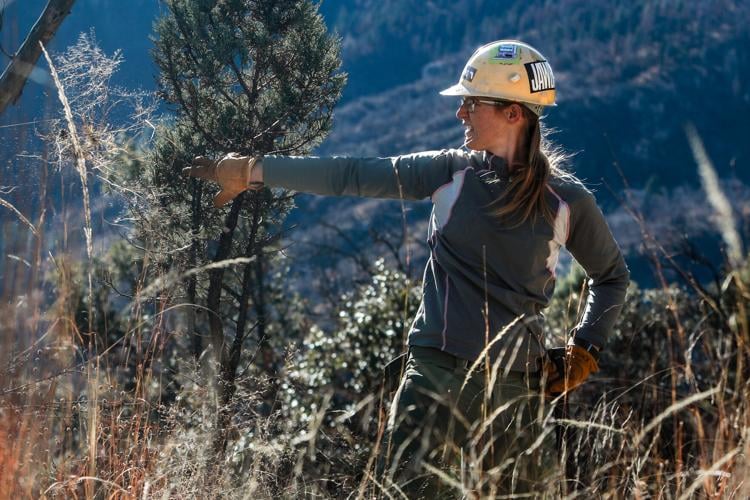
Kimberly McElroy cleans up burned debris at the Butterfly Trailhead in the Santa Catalina Mountains.
The trail comment process is informal, not under National Environmental Policy Act processes required for work with environmental impact.
тAfter we get the comments we will have a series of meetings, and perhaps focus groups with partners. We will let the feedback inform the rest of the process,т Milnor said.
The next step will be to create a conceptual map of a future desired trail system by midsummer.
Milnor foresees rerouting some trails, making new connections, improving trailheads and parking in some areas, and even choosing not to maintain certain trails.
тWe will be referring to these comments for years to come,т Milnor said. He is the main contact for the project, and comments can be sent to him by email (adam.milnor@usda.gov).

This photo of the Green Mountain Trail was taken not long after the Bighorn Fire in 2020.
Of comments submitted so far, some offer extremely specific knowledge and advice for certain areas, potential connections and modifications to reduce conflicts. Others are quite general.
Mountain bikers so far have offered the most comments, requesting more moderate and connector trails, downhill alternatives to reduce user conflicts, and nonmotorized trails utilizing or supplementing existing jeep road areas such as Redington Pass and Oracle Ridge.

Volunteers work on the Green Mountain Trail in the Santa Catalina Mountains.
Dog walkers would like more lower trails open for leashed dogs while others maintain no dogs should be allowed in the Catalinas. Commenters also called for a bigger Forest Service field staff and mention concerns beyond the scope of the trails system: garbage, unauthorized shooting, drones and rude hikers with poor trail etiquette.
тReopen all the trails,т said one commenter. тA year of trail closure is unacceptable.т
Ranger Woodward said many recreationists now better understand the closures and even warn others of unsafe areas. His message to the public: тBe patient with us as we work to reopen the trails and try to balance all kinds of recreation users and interests.т
A look back at the Bighorn Fire in photos
Bighorn Fire in the Santa Catalina Mountains, 2020

A DC-10 air tanker or VLAT (Very Large Air Tanker) dumps thousands of gallons of retardant on the Bighorn Fire burning along Pusch Ridge in Coronado National Forest east of Rams Canyon subdivision on June 6, 2020.
Bighorn Fire - УлшжжБВЅ

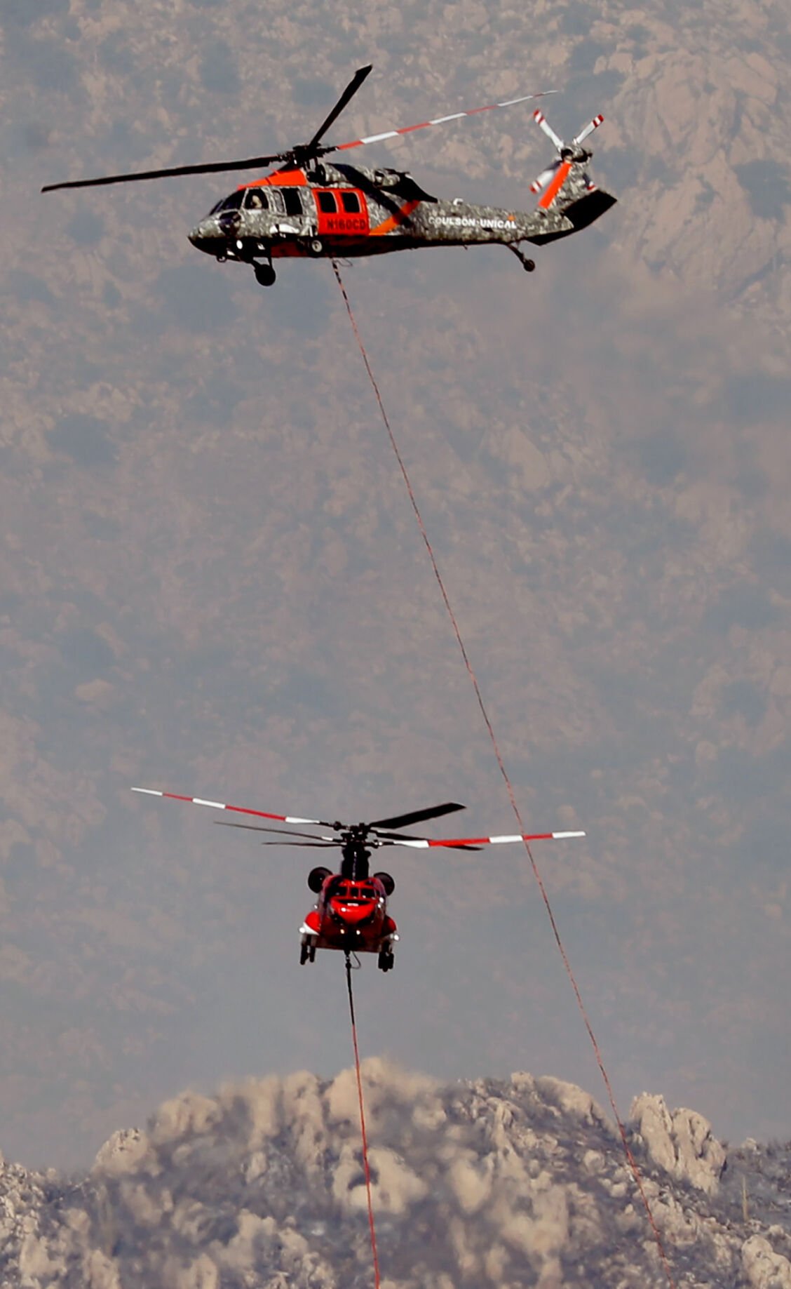
A Chinook heavy lift helicopter passes smoke from the Bighorn Fire burning along Pusch Ridge in Coronado National Forest north of УлшжжБВЅ on June 6, 2020.
Bighorn Fire in the Santa Catalina Mountains, 2020

Smoke from the Bighorn Fire shrouds granite formations of Pusch Ridge in Coronado National Forest north of УлшжжБВЅ on June 6, 2020.
Bighorn Fire - УлшжжБВЅ

People watch the aerial ballet of helicopters and air tankers on the Bighorn Fire from the safety of Oro Valley Marketplace on June 7, 2020.
Bighorn Fire - УлшжжБВЅ

A DC-10 air tanker spreads a line of retardant high atop Pusch Ridge as fire managers tried in vain to keep the the Bighorn Fire confined to the West end of the Santa Catalina Mountains in Coronado National Forest north of УлшжжБВЅ on June 6, 2020.
Bighorn Fire - УлшжжБВЅ

The Bighorn Fire burning above Catalina State Park in the Santa Catalina Mountains in Coronado National Forest north of УлшжжБВЅ on June 7, 2020.
Bighorn Fire - УлшжжБВЅ

Dark smoke from the Bighorn Fire in the upper elevations of Pima Canyon obscures the rising sun above the Santa Catalina Mountains in Coronado National Forest north of УлшжжБВЅ on June 9, 2020.
Bighorn Fire in the Santa Catalina Mountains, 2020

A helicopter dips into Rose Canyon Lake for water while fighting the Bighorn Fire still burning in the west end fo the Santa Catalina Mountains on June 9, 2020.
Bighorn Fire - УлшжжБВЅ

The Bighorn Fire consumes thick vegetation in crags above Pima Canyon within the Santa Catalina Mountains in Coronado National Forest north of УлшжжБВЅ on June 9, 2020.
Bighorn Fire in the Santa Catalina Mountains, 2020

A Chinook helicopter drops a load of water on the Bighorn Fire as is moves into the top of Finger Rock Canyon and up Mount Kimball, on June 10, 2020.
Bighorn Fire in the Santa Catalina Mountains, 2020

The Bighorn Fire burns up into juniper, mesquite and heavier fuel as it approaches Mt. Kimball in the Santa Catalina Mountains, УлшжжБВЅ, Ariz., June 10, 2020.
Bighorn Fire - УлшжжБВЅ
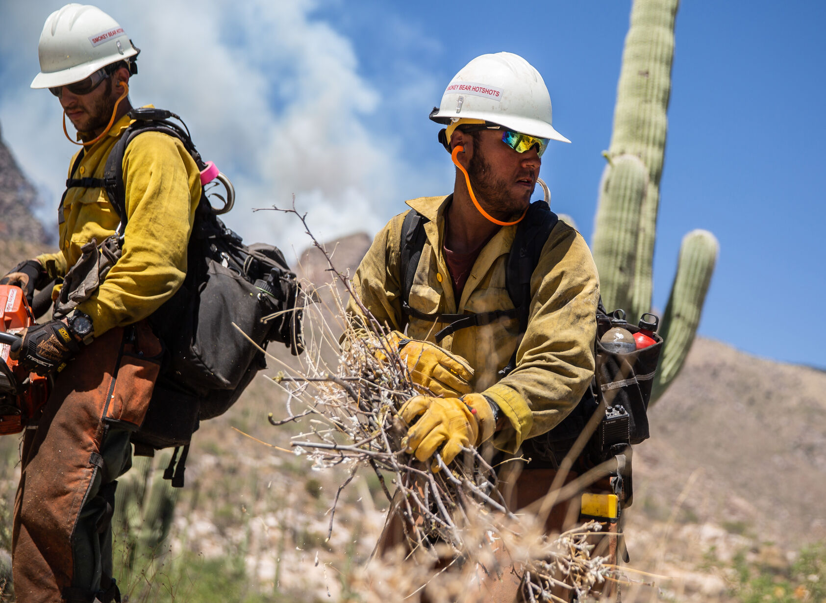
Adam Hutton with the Smokey Bear Hotshots of Ruidoso, New Mexico tosses away brush being cut near the mouth of Finger Rock Canyon as a precaution against the growing Bighorn Fire being fought in the Santa Catalina Mountain Range, on June 10, 2020.
Bighorn Fire in the Santa Catalina Mountains, 2020

The Bighorn Fire breaks onto the southern slopes of the Santa Catalina Mountains and burns over a pair of homes in the foothills just west of the Finger Rock Trailhead, УлшжжБВЅ, Ariz., June 10, 2020.
Bighorn Fire - УлшжжБВЅ

The Bighorn Fire churns through brush, creating a smoky mess in Pima Canyon and Finger Rock Canyon in the Santa Catalina Mountains north of УлшжжБВЅ on June 11, 2020.
Bighorn Fire in the Santa Catalina Mountains, 2020

A DC-10 air tanker (VLAT) drops fire retardant behind homes in the Cobblestone Estate during the Bighorn Fire in the Santa Catalina Mountains on June 11, 2020.
Bighorn Fire in the Santa Catalina Mountains, 2020

Residents watch a Neptune Aviation air tanker drop fire retardant behind the Santa Catalina foothills north of УлшжжБВЅ, Ariz. on June 11, 2020.
Bighorn Fire - УлшжжБВЅ

A hot shot fire crew hikes a ridge near Finger Rock Canyon in the Santa Catalina Mountains during the Bighorn Fire on June 11, 2020.
Bighorn Fire in the Santa Catalina Mountains, 2020

Keith Lencke of the Blue Ridge Hotshots watches the air attack on the Bighorn Fire in the Cobblestone Estates neighborhood in the Santa Catalina foothills on June 11, 2020.
Bighorn Fire in the Santa Catalina Mountains, 2020

Qin Chen talks with Tom Lemmons of the Pima County Sheriff's Office Auxiliary, about "Go" orders given to evacuate her home in the Cobblestone Estates neighborhood due to the Bighorn Fire in the Santa Catalina Mountains on June 11, 2020.
Bighorn Fire in the Santa Catalina Mountains, 2020

A Chinook helicopter dumps water on a slope during the Bighorn Fire in the Santa Catalina Mountains on June 11, 2020. Pinkish-red fire retardant coats the rock faces of the mountain range.
Bighorn Fire - УлшжжБВЅ

A DC-10 air tanker (VLAT) drops a line of retardant on a ridge above homes east of Pima Canyon in the Santa Catalina foothills during the Bighorn Fire on June 11, 2020.
Bighorn Fire in the Santa Catalina Mountains, 2020

A DC-10 VLAT makes a final drop in the fading light over the homes in the area between Swan and Alvernon during the daylong struggle to keep the Bighorn Fire out of the neighborhoods of the Santa Catalina Mountain foothills, УлшжжБВЅ, Ariz., June 11, 2020.
Bighorn Fire in the Santa Catalina Mountains, 2020

People watch from Oracle Road just north of the entrance to Catalina State Park as Chinook helicopters drop water on the Bighorn Fire which is burning for its seventh day in the western Santa Catalina mountain range, on June 12, 2020.
Bighorn Fire in the Santa Catalina Mountains, 2020

Smoke billows from the Bighorn Fire burning in the Pusch Ridge Wilderness, on June 12, 2020.
Bighorn Fire in the Santa Catalina Mountains, 2020
Two firefighting helicopters maneuver around one another while recharging at a dip site as the battle moves to the north to keep the Bighorn Fire from spreading, Oro Valley, Ariz., June 11, 2020.
Bighorn Fire in the Santa Catalina Mountains, 2020

A DC-10 VLAT drops below the ridge line as the aerial battle moves to the northwest and crews work to keep the Bighorn Fire from spreading through Catalina State Park, Oro Valley, Ariz., June 11, 2020.
Bighorn Fire in the Santa Catalina Mountains, 2020

A Chinook helicopter drops water on the line of flames advancing through grasslands at the northwestern foot of the Santa Catalinas as crews work to keep the Bighorn Fire from spreading through Catalina State Park, Oro Valley, Ariz., June 11, 2020.
Bighorn Fire in the Santa Catalina Mountains, 2020

The Bighorn Fire's northwestern front looms over homes as it burns into the central Santa Catalina Mountains, Oro Valley, Ariz., June 13, 2020.
Bighorn Fire in the Santa Catalina Mountains, 2020

A group of friends hangout on a high rock at Windy Point Vista while smoke from the Bighorn Fire flows over Mount Lemmon north of УлшжжБВЅ, Ariz. on June 14, 2020.
Bighorn Fire in the Santa Catalina Mountains, 2020

A Pima County Sheriff Auxiliary Volunteer motions for a four-wheel drive Type 3 fire engine from Three Points FD to proceed to Mount Lemmon on the Catalina Highway on June 15, 2020..
УлшжжБВЅ Wildfires

A DC-10 air tanker drops fire retardant along Samaniego Ridge just west of Mt. Lemmon Sky Center during the Bighorn Fire burning west of Mt. Lemmon in the Santa Catalina Mountains north of УлшжжБВЅ on June 16, 2020.
Bighorn Fire in the Santa Catalina Mountains, 2020

A Sikorsky firefighting helicopter drops water along a ridge top as the flames from the Bighorn Fire work their way onto the northern slopes of the Santa Catalina Mountains, УлшжжБВЅ, Ariz., June 16, 2020.
Bighorn Fire in the Santa Catalina Mountains, 2020

The same wind whipping the flags outside the Fairfield Inn & Suites on Oracle Road is whipping up the flames and smoke of the Bighorn Fire, Oro Valley, Ariz., June 17, 2020.
Bighorn Fire in the Santa Catalina Mountains, 2020

Flames break through the smoke as a finger of the Bighorn Fire scorches its way through a canyon on the west side of the Santa Catalina Mountains above Oro Valley on June 17, 2020.
Bighorn Fire in the Santa Catalina Mountains, 2020

People use a wildlife exit along Oracle Road to get a view of the Bighorn Fire churning through heavy fuels like Ponderosa pines below Summerhaven on June 17, 2020.
Bighorn Fire in the Santa Catalina Mountains, 2020

The Bighorn Fire became of machine of heat and wind, consuming incinerating large stands of trees on June 17, 2020.
Bighorn Fire in the Santa Catalina Mountains, 2020

A firefighting helicopter flies over a smoke filled canyon as it shuttles water to a line between the Bighorn Fire and Oracle, УлшжжБВЅ, Ariz., June 18, 2020.
Bighorn Fire in the Santa Catalina Mountains, 2020

The Bighorn Fire burning in Ventana Canyon in the Santa Catalina Mountains as the fire became a daily spectacle, viewable from nearly anywhere in УлшжжБВЅ, on June 18, 2020.
Bighorn Fire in the Santa Catalina Mountains, 2020

Traffic on Sabino Canyon Road drives under the glow of he Bighorn Fire as it claims Ventana Canyon on the south slopes of the Santa Catalina Mountains on June 19, 2020.
Bighorn Fire in the Santa Catalina Mountains, 2020

Flames on the outer eastern walls of Ventana Canyon as the Bighorn Fire continues burning the Santa Catalina Mountains on June 20, 2020.
Bighorn Fire in the Santa Catalina Mountains, 2020

Smoke would lay-in over the city on days with calm winds as the Bighorn Fire methodically progressed through he Santa Catalina range. Photo taken on June 21, 2020 from "A" Mountain.
Bighorn Fire in the Santa Catalina Mountains, 2020

Flames from the Bighorn Fire climb over a ridge near Esperero Canyon, silhouetting a stand of Saguaros as the blaze marches east on June 23, 2020.
Bighorn Fire in the Santa Catalina Mountains, 2020

Smoke from the Bighorn Fire clings to the foothills of the eastern slopes of the Santa Catalina and Rincon mountains and the cottonwood-willow forest and mesquite bosque running along the San Pedro River Valley, Cascabel, Ariz., June 30, 2020.
Bighorn Fire in the Santa Catalina Mountains, 2020

Bighorn Fire scar area: CaУБada del Oro basin looking south at Sanmaniego Ridge in the Santa Catalina Mountains north of УлшжжБВЅ on July 1, 2020. The summit of Mt Lemmon is at left.
Bighorn Fire in the Santa Catalina Mountains, 2020

Bighorn Fire scar area: Looking from East Ski Run toward Oracle Ridge, left, and Sanmaniego Ridge, right, in the Santa Catalina Mountains north of УлшжжБВЅ on July 10, 2020.
Bighorn Fire in the Santa Catalina Mountains, 2020

Summerhaven sits like an island surrounded Bighorn Fire scar and Aspen Fire scar from 2003 in these aerial photos from July 15, 2020. The Mt. Lemmon Fire Station and control road jut out from a U-shaped turn of Mt. Lemmon Highway at upper left.
Bighorn Fire in the Santa Catalina Mountains, 2020

Bighorn Fire scar area: Charred debris from the Bighorn Fire moves down the CaУБada del Oro Wash after a monsoon storm on July 15, 2020.
Bighorn Fire in the Santa Catalina Mountains, 2020

A burned section of the Catalina Mountains seen near Aspen Vista Point, on Aug. 1, 2020.
Bighorn Fire in the Santa Catalina Mountains, 2020

Deymo Fernandez, left, and Sara Hernandez, look at a burn scar from the Bighorn Fire on the North side of Mount Lemmon outside the Iron Door Restaurant in Mount Lemmon on August 2, 2020..
Bighorn Fire in the Santa Catalina Mountains, 2020

The burn scar from the Bighorn Fire on a portion of the North side of Mount Lemmon, as seen from the Mount Lemmon Fire Station on August 2, 2020.
Bighorn Fire in the Santa Catalina Mountains, 2020

Gregg Sasek, dispersed recreation manager for the Coronado National Forest Santa Catalina Ranger District, demonstrates how ground along the Palisade Trail has been burnt out making it easy for hikers to sink a leg into the soil, on Aug. 12, 2020. Various dangers are still being accessed throughout the Coronado National Forest as a result of the Bighorn Fire.
Bighorn Fire in the Santa Catalina Mountains, 2020

A sign at the entrance to the Pima Canyon Trail warns hikers of dangers after the Bighorn Fire damages hiking areas on September 30, 2020.
Bighorn Fire in the Santa Catalina Mountains, 2020

Snow covers a burn scar from the Bighorn Fire in the Santa Catalina Mountains outside of Summerhaven, Ariz. on Nov. 9, 2020. The Mt. Lemmon General Store in Summerhaven got about 1-2 inches of snow early Monday, according to the National Weather Service.
Bighorn Fire in the Santa Catalina Mountains, 2020

Damage from the Bighorn Fire can be seen along the Marshall Gulch Trail on Mt. Lemmon in УлшжжБВЅ, Ariz. on May 25, 2021.
Bighorn Fire in the Santa Catalina Mountains, 2020

Rosalind Perera walks along the Aspen Trail where damage from the Bighorn Fire can be seen on Mt. Lemmon in УлшжжБВЅ, Ariz. on May 25, 2021.
Bighorn Fire in the Santa Catalina Mountains, 2020

Damage from the Bighorn Fire can be seen along the Aspen Trail on Mt. Lemmon in УлшжжБВЅ, Ariz. on May 25, 2021.