

Several trails in Sabino Canyon will partially reopen on Monday, officials announced Friday.
However, the shuttle and the visitor center will remain closed. Restrooms and trash services are not available at all recreation areas.
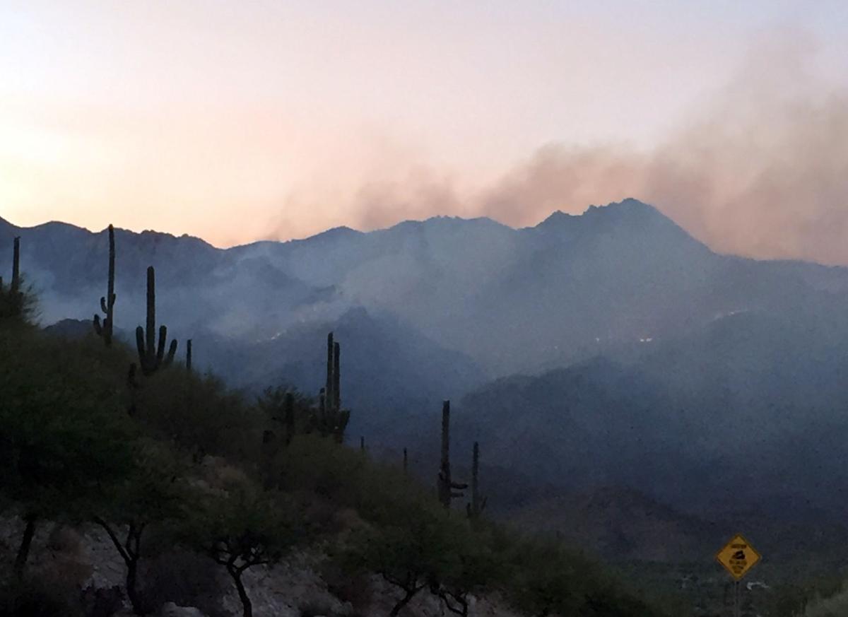
Sabino Canyon has been closed since the massive Bighorn Fire swept across the Catalina Mountains. Lightning started the wildfire June 5 and burned about 120,000 acres by the time the Forest Service declared it fully contained on July 23.
Some areas along Catalina Highway on Mount Lemmon reopened Sept. 1.
Wildfires such as the Bighorn Fire north of УлшжжБВЅ leave the ground charred and unable to absorb water, which can increase flood risks. тEven a light rain can produce devastating flash floods and mudflows, often with little warning,т Pima County officials warned. In this July 2020 video, a debris flow oozes down the CaУБada del Oro Wash.
"We've worked to implement emergency treatments so we can provide as many recreation opportunities to the public as possible." CJ Woodard, Santa Catalina District Ranger, said in a news release.
"Visitors should be aware that Sabino Canyon looks different after the fire ..." Woodard continued in the release. "Hazards still exist in the burn scar and the general forest, so I implore visitors to be safe, heed the signs, and be vigilant."
People are also reading…
The order reopening parts of Sabino are expected to remain in effect until Nov. 1.
For information about activities available in the recreation area go to the Coronado National Forest website, , or call the Santa Catalina Ranger District office at (520)749-8700.
Photos: The Bighorn Fire burn scar in the Santa Catalina Mountains
Bighorn Fire Burn Scar, hiking trails

Gregg Sasek, dispersed recreation manager for the Coronado National Forest Santa Catalina Ranger District, demonstrates how ground along the Palisade Trail has been burnt out making it easy for hikers to sink a leg into the soil, on Aug. 12, 2020. Various dangers are still being accessed throughout the Coronado National Forest as a result of the Bighorn Fire. Pool photo by Josh Galemore / УлшжжБВЅ
Bighorn Fire Burn Scar, hiking trails

Santa Catalina District Ranger CJ Woodard looks at the burn scar caused by the Bighorn Fire along the Palisade Trail in the Santa Catalina Ranger District of the Coronado National Forest, on Aug. 12, 2020. Pool photo by Josh Galemore / УлшжжБВЅ
Bighorn Fire Burn Scar, hiking trails

A scorched tree along the Palisade Trail in the Santa Catalina Ranger District of the Coronado National Forest, on Aug. 12, 2020. Dangers including burnt vegetation, unstable trees and loose soil as a result of the Bighorn Fire are being accessed by the Forest Service before trails in the area are opened to the public. Pool photo by Josh Galemore / УлшжжБВЅ
Bighorn Fire Burn Scar, hiking trails

A tree uprooted by burnt roots and soil as a result of the Bighorn Fire along the Palisade Trail in the Santa Catalina Ranger District of the Coronado National Forest, on Aug. 12, 2020. Pool photo by Josh Galemore / УлшжжБВЅ
Bighorn Fire Burn Scar, hiking trails

Gregg Sasek, dispersed recreation manager with the Coronado National Forest Santa Catalina Ranger District, leads media and other Forest Service workers along the Palisade Trail to showcase various types of damage done to wilderness area as a result of the Bighorn Fire, on Aug. 12, 2020. Pool photo by Josh Galemore / УлшжжБВЅ
Bighorn Fire Burn Scar, hiking trails

A scorched tree along the Palisade Trail in the Santa Catalina Ranger District of the Coronado National Forest, on Aug. 12, 2020. Dangers including burnt vegetation, unstable trees and loose soil as a result of the Bighorn Fire are being accessed by the Forest Service before trails in the area are opened to the public. Pool photo by Josh Galemore / УлшжжБВЅ
Bighorn Fire Burn Scar, hiking trails

Ponderosa Pines charred by the Bighorn Fire stand along the Palisade Trail in the Santa Catalina Ranger District of the Coronado National Forest, on Aug. 12, 2020. Pool photo by Josh Galemore / УлшжжБВЅ
Bighorn Fire Burn Scar, hiking trails

A tree uprooted and burnt as a result of the Bighorn Fire along the Palisade Trail in the Santa Catalina Ranger District of the Coronado National Forest, on Aug. 12, 2020. Pool photo by Josh Galemore / УлшжжБВЅ
Bighorn Fire Burn Scar, hiking trails

Gregg Sasek, dispersed recreation manager with the Coronado National Forest Santa Catalina Ranger District, carries a combi-tool (a woodland fire tool which combines a shovel and pick) as he leads media and other Forest Service personnel along the Palisade Trail to showcase various types of damage done to wilderness area as a result of the Bighorn Fire, on Aug. 12, 2020. Pool photo by Josh Galemore / УлшжжБВЅ
Bighorn Fire Burn Scar, hiking trails

Forest Service personnel and media walk through a burn scar caused by the Bighorn Fire along the Palisade Trail in the Santa Catalina Ranger District of the Coronado National Forest, on Aug. 12, 2020. Pool photo by Josh Galemore / УлшжжБВЅ
Bighorn Fire Burn Scar, hiking trails

Forest Service personnel and media walk through a burn scar caused by the Bighorn Fire along the Palisade Trail in the Santa Catalina Ranger District of the Coronado National Forest, on Aug. 12, 2020. Pool photo by Josh Galemore / УлшжжБВЅ
Bighorn Fire Burn Scar, hiking trails

Gregg Sasek, dispersed recreation manager with the Coronado National Forest Santa Catalina Ranger District, leads media and other Forest Service workers along the Palisade Trail to showcase various types of damage done to wilderness area as a result of the Bighorn Fire, on Aug. 12, 2020. Pool photo by Josh Galemore / УлшжжБВЅ
Bighorn Fire Burn Scar, hiking trails

A fern sprouts from the soil in a burnt out area along the Palisade Trail in the Santa Catalina Ranger District of the Coronado National Forest, on Aug. 12, 2020. Pool photo by Josh Galemore / УлшжжБВЅ
Bighorn Fire Burn Scar, hiking trails

Gregg Sasek, dispersed recreation manager with the Coronado National Forest Santa Catalina Ranger District, checks tree tops for signs of burn while leading media and other Forest Service workers along the Palisade Trail to showcase various types of damage done to wilderness area as a result of the Bighorn Fire, on Aug. 12, 2020. Pool photo by Josh Galemore / УлшжжБВЅ
Bighorn Fire Burn Scar, hiking trails

A burn scar along the Palisade Trail in the Santa Catalina Ranger District of the Coronado National Forest, on Aug. 12, 2020. Pool photo by Josh Galemore / УлшжжБВЅ
Bighorn Fire Burn Scar, hiking trails

A tree base scorched by the Bighorn Fire along the Palisade Trail in the Santa Catalina Ranger District of the Coronado National Forest, on Aug. 12, 2020. The weakening of the base makes it easier for trees to fall and are a serious danger to hikers. Pool photo by Josh Galemore / УлшжжБВЅ
Bighorn Fire Burn Scar, hiking trails

Gregg Sasek, dispersed recreation manager with the Coronado National Forest Santa Catalina Ranger District, walks by a "leaner" (an uprooted tree hung up on another tree or object) as he leads media and other Forest Service workers along the Palisade Trail to showcase various types of damage done to wilderness area as a result of the Bighorn Fire, on Aug. 12, 2020. Pool photo by Josh Galemore / УлшжжБВЅ
Bighorn Fire Burn Scar, hiking trails

A burn scar from the Bighorn Fire along a hilltop near the Palisade Trail in the Santa Catalina Ranger District of the Coronado National Forest, on Aug. 12, 2020. Pool photo by Josh Galemore / УлшжжБВЅ
Bighorn Fire Burn Scar, hiking trails

Scorched pine needles along the Palisade Trail in the Santa Catalina district of the Coronado National Forest, on Aug. 12, 2020. Pool photo by Josh Galemore / УлшжжБВЅ
Bighorn Fire

Bighorn Fire scar north of Summerhaven, Ariz, right, on July 15, 2020. The Mt. Lemmon Fire station is top center in the photo.
Bighorn Fire

Bighorn Fire in the Santa Catalina Mountains below Summerhaven, Ariz, right, on July 15, 2020.
Bighorn Fire

Bighorn Fire scar in the Santa Catalina Mountains north of Summerhaven (lower right) on July 15, 2020.
Bighorn Fire

Bighorn Fire scar in the Santa Catalina Mountains below the town of Summerhaven on July 15, 2020.
Bighorn Fire

The Mt. Lemmon Control Road cuts through the Bighorn Fire scar on the north side of the Santa Catalina Mountains near Oracle, Ariz., on July 15, 2020.
Bighorn Fire

Bighorn Fire scar below Mt. Lemmon in the Santa Catalina Mountains on July 15, 2020.
Bighorn Fire

Bighorn Fire scar area: CaУБada del Oro basin looking south at Samaniego Ridge in the Santa Catalina Mountains north of УлшжжБВЅ on July 1, 2020. The summit of Mt Lemmon is at left.
Bighorn Fire

The Bighorn Fire scar area shown looking from East Ski Run toward Oracle Ridge, left, and Sanmaniego Ridge, right, in the Santa Catalina Mountains north of УлшжжБВЅ.
Bighorn Fire

Bighorn Fire scar area: South face of Mt Kimball on July 3, 2020, in the Santa Catalina Mountains north of УлшжжБВЅ.
Bighorn Fire

Bighorn Fire scar area: Regional Flood Control Staff installing a new real-time ALERT rainfall monitoring site in the burn area in the Santa Catalina Mountains north of УлшжжБВЅ in July, 2020. These are the backbone of the flash flood warning system.
Bighorn Fire

Charred debris from the Bighorn Fire moves down the CaУБada del Oro Wash after a monsoon storm on July 15, 2020.
Bighorn Fire

Charred debris from the Bighorn Fire moves down the CaУБada del Oro Wash after a monsoon storm on July 15, 2020.


