

Photos: The Bighorn Fire in Coronado National Forest near УлшжжБВЅ
The lightning-caused Bighorn Fire started June 5, 2020, and burned through the rocky, steep Pusch Ridge area and moved into Pima Canyon, Finger Rock Canyon and Pontatoc Canyon on the front range, forcing evacuations of homes near the boundary with Coronado National Forest.
On the north side of the range, the fire burned into Catalina State Park in Oro Valley, south of the the town of Catalina, Summerhaven and areas around Mt. Lemmon and into the foothills south of the town of Oracle. It also forced evacuations in the lower San Pedro River Valley (the town of Redington) as the fire moved into grasslands and down the canyons extending off the east end of the Santa Catalina Mountain range.Т
Ultimately, the fire burned nearly 120,000 acres т touching nearly all elevations of the range. The fire burned through late July.
Bighorn Fire
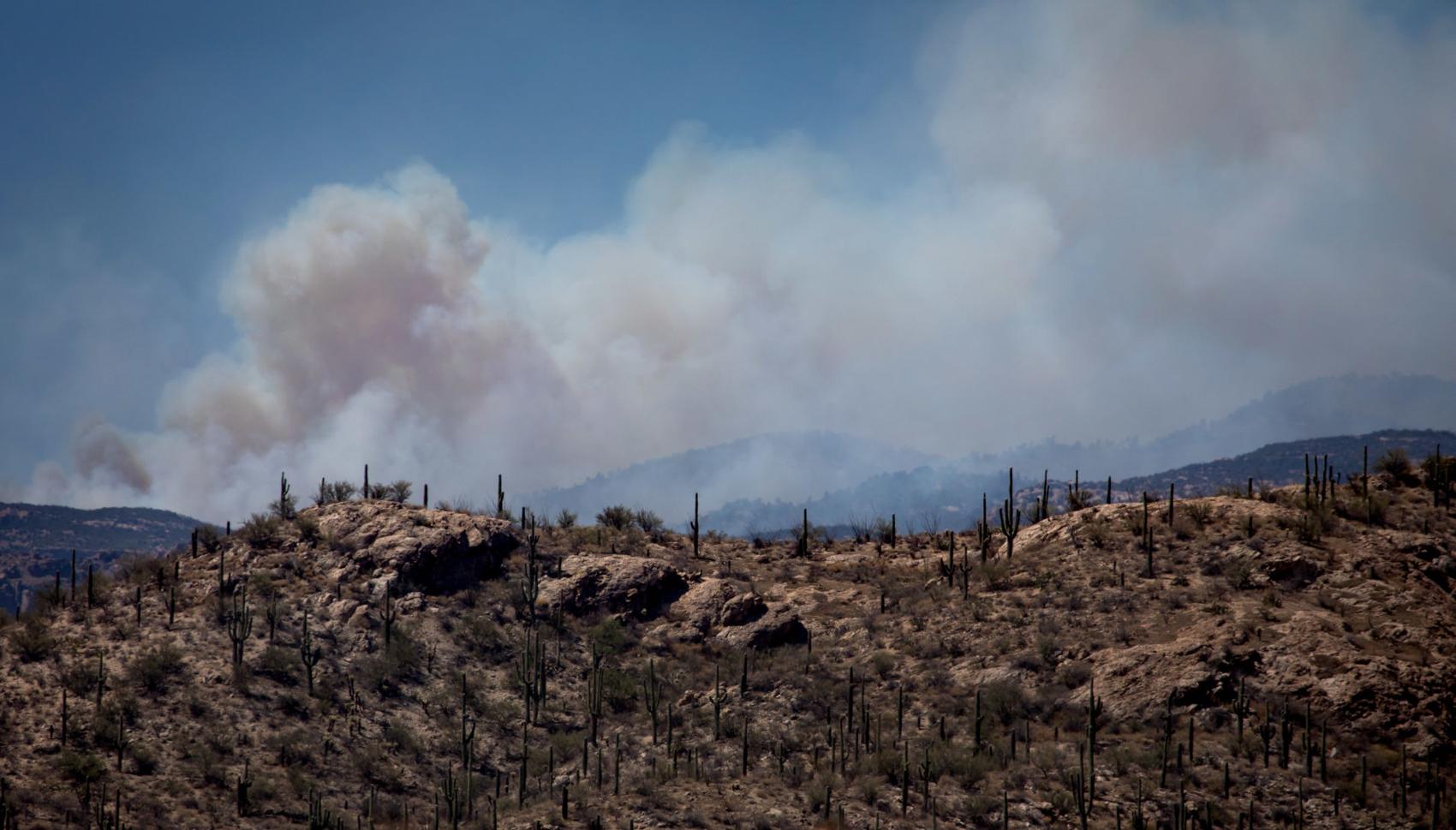
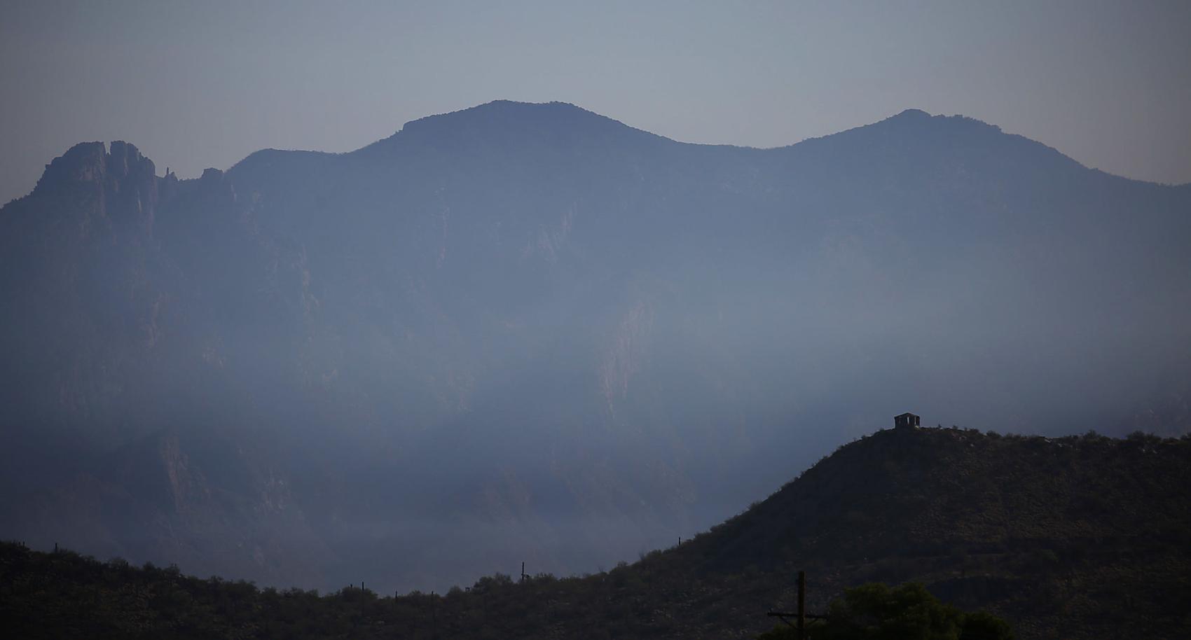
Smoke from the Bighorn Fire colors the skies over the eastern slopes of the Santa Catalina and Rincon mountains, Cascabel, Ariz., June 30, 2020.
Bighorn Fire
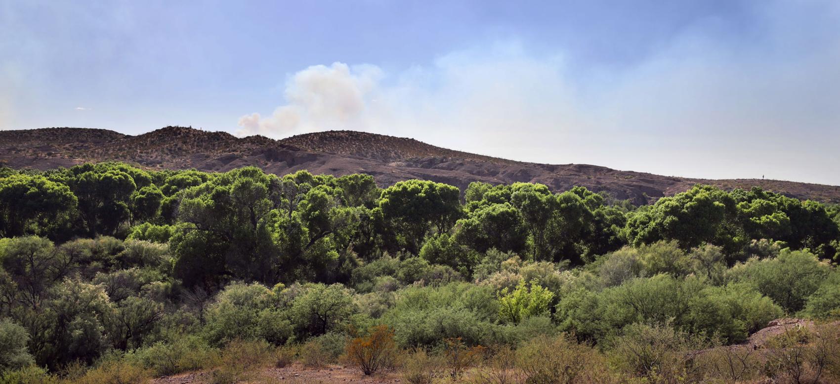
Smoke from the Bighorn Fire puffs above the cottonwood-willow forest running along the San Pedro River valley, Cascabel, Ariz., June 30, 2020.
Bighorn Fire
Smoke from the Bighorn fire blows Northeast over the Catalina mountains on June 30, 2020 in УлшжжБВЅ, Ariz. Photo taken from E. Speedway Blvd.
Bighorn Fire

Bighorn Fire burn area on Samaniego Ridge in the Santa Catalina Mountains looking west toward Biosphere II on June 27, 2020.
Bighorn Fire

Bulldozer clearing vegetation on the Northeast corner of the Bighorn Fire burning in and around the Santa Catalina Mountains on June 27, 2020.
Bighorn Fire

Crews working the Bighorn Fire near Summerhaven, Ariz., in the Santa Catalina Mountains on June 23, 2020.
Bighorn Fire
West winds push the smoke of the Bighorn Fire as it burns on the southeastern slopes of the Santa Catalina Mountains, УлшжжБВЅ, Ariz., June 26, 2020. The lights on the antennas of Mount Bigelow are just visible at right through the smoke.
Bighorn Fire

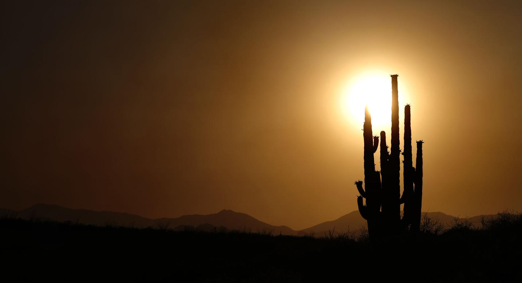
Flames from the Bighorn Fire climb over a ridge near Esperero Canyon lighting up a stand of saguaro as the blaze continues relentlessly to the east on the southern slopes of the Santa Catalina Mountains, УлшжжБВЅ, Ariz., June 23, 2020. Engine crews were monitoring the fire, which was largely beneficial and no threat to homes.
Bighorn Fire
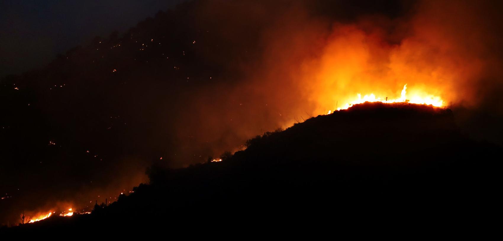
Flames from the Bighorn Fire rise over a ridge near Esperero Canyon as the blaze moves east on the southern slopes of the Santa Catalina Mountains, УлшжжБВЅ, Ariz., June 23, 2020.
Bighorn Fire
Smoke from the Bighorn Fire covers the Santa Catalina Mountains with Sentinel Peak seen in the foreground Tuesday morning on June 23, 2020.
Bighorn Fire

From Ventana Canyon, at left, to just north of the end of Houghton Road, the Bighorn Fire stretches along the southern slopes of the Santa Catalina Mountains, УлшжжБВЅ, Ariz., June 20, 2020.
Bighorn Fire
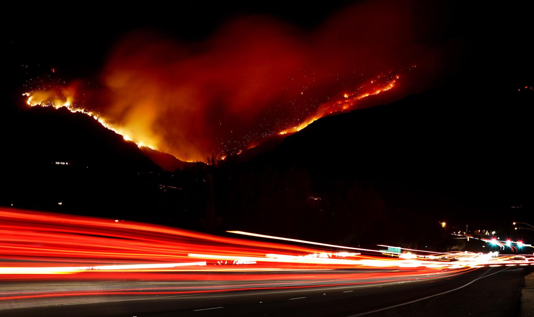
Traffic on Sabino Canyon Road drives under the glow of he Bighorn Fire as it claims Ventana Canyon on the south slopes of the Santa Catalina Mountains, УлшжжБВЅ, Ariz., June 19, 2020.
Bighorn Fire

The Bighorn Fire burning in Ventana Canyon in the Santa Catalina Mountains behind downtown УлшжжБВЅ on June 18, 2020.
Bighorn Fire

Flames return to the southern slopes as the Bighorn Fire continues to burn through the heart of the Santa Catalina Mountains, УлшжжБВЅ, Ariz., June 18, 2020.
Bighorn Fire

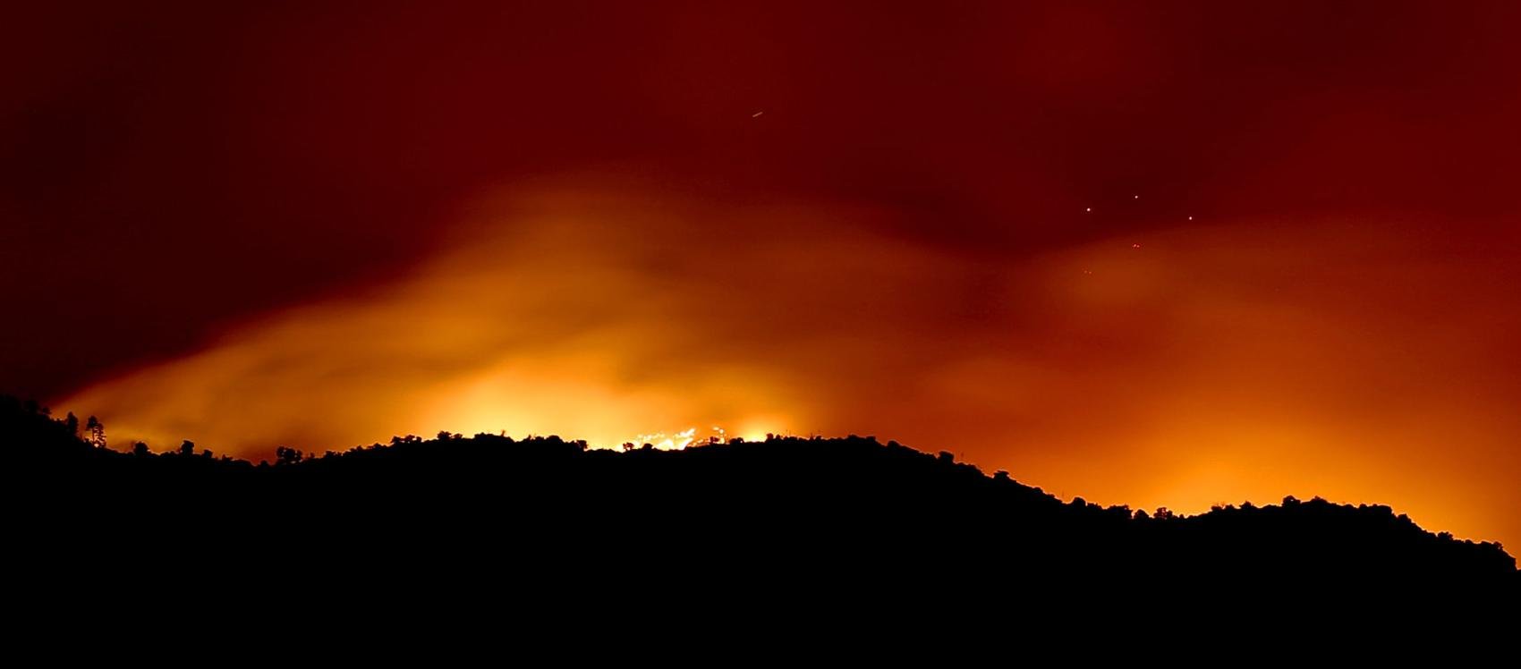
Radio Ridge, near the top of the Santa Catalinas, is silhouetted by flames from the Bighorn Fire on the southern seen from near, Oracle, Ariz., June 18, 2020.
Bighorn Fire

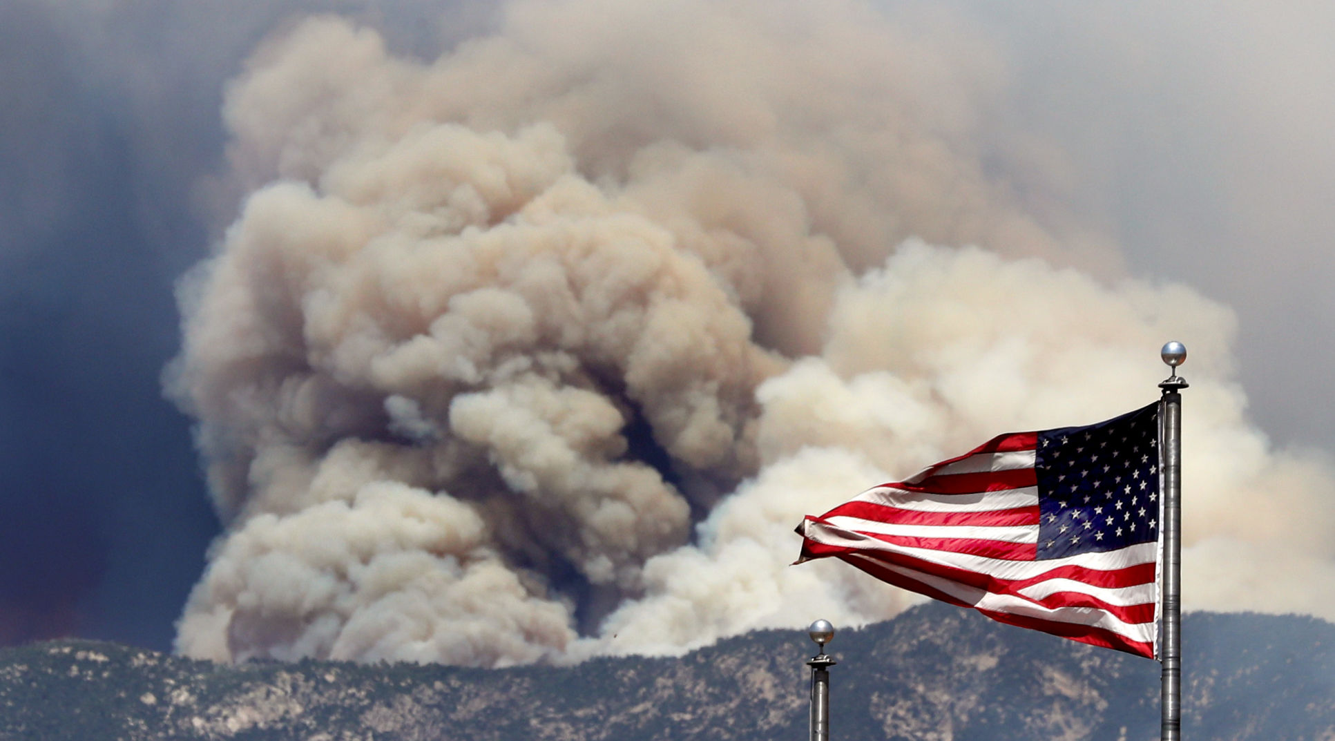
Passersby use a wildlife exit along Oracle Road to get an elevated view the smoke billowing out of the northwestern portion of the Bighorn Fire, Oro Valley, Ariz., June 17, 2020.
Bighorn Fire

The Bighorn Fire lights up the ridge overlooking Saddlebrooke in the northwestern foothills of the Santa Catalina Mountains, УлшжжБВЅ, Ariz., June 17, 2020.
Bighorn Fire

Smoke billows from the Santa Catalinas as the Bighorn Fire continues to burn as seen from Honey Bee Canyon Park in Oro Valley, on June 17, 2020.
Bighorn Fire
The same wind whipping the flags outside the Fairfield Inns & Suites on Oracle Road is whipping up the flames and smoke of the Bighorn Fire, Oro Valley, Ariz., June 17, 2020.
Bighorn Fire

Flames break through the smoke as a finger of the Bighorn Fire scorches its way through a canyon on the west side of the Santa Catalina Mountains, УлшжжБВЅ, Ariz., June 17, 2020.
Bighorn Fire

A stand of pines go up in flames as the Bighorn Fire pushes its way down a slope on the northern side of the Santa Catalina Mountains, УлшжжБВЅ, Ariz., June 16, 2020.
Bighorn Fire

A DC-10 VLAT makes a slurry drop near the observatory site and along the burnout of the 17 year-old Aspen Fire as crew fight to keep the Bighorn Fire being advancing on Mount Lemmon, УлшжжБВЅ, Ariz., June 16, 2020.
Bighorn Fire

The Bighorn Fire crest a ridge on the north side of the Santa Catalina Mountains as the day's steady winds push the flames closer to Mount Lemmon, УлшжжБВЅ, Ariz., June 16, 2020.
Bighorn Fire

A Sikorsky firefighting helicopter drops water along a ridge top as the flames from the Bighorn Fire work their way onto the northern slopes of the Santa Catalina Mountains, УлшжжБВЅ, Ariz., June 16, 2020.
Bighorn Fire- УлшжжБВЅ

A DC-10 VLAT climbs out of the range after making a slurry drop between The Bighorn Fire and Mount Lemmon, УлшжжБВЅ, Ariz., June 16, 2020.
Bighorn Fire

A fire engine from Three Points Fire District west of УлшжжБВЅ passes a Pima County Sheriff Auxiliary Volunteer on its way up the Catalina Highway to Mount Lemmon on June 15, 2020. Several local fire districts supply equipment and firefighters to fight the Bighorn Fire.
Bighorn Fire- УлшжжБВЅ

Sierra National Forest hotshot crew members talk about wind patterns while preparing for a possible change in direction from the Bighorn Fire on Mount Lemmon in the Santa Catalina Mountains in Ariz. on June 14, 2020.
Bighorn Fire- УлшжжБВЅ

A Sierra National Forest hotshot crew member measures the wind while preparing for a possible change in direction from the Bighorn Fire on Mount Lemmon in the Santa Catalina Mountains in Ariz. on June 14, 2020.
Bighorn Fire- УлшжжБВЅ

Smoke flows out of canyons in the Santa Catalina Mountains from the Bighorn Fire north of УлшжжБВЅ, Ariz. on June 14, 2020, as seen from Mount Lemmon Trail #5.
Bighorn Fire- УлшжжБВЅ

Smoke from the Bighorn Fire burning in canyons in the Santa Catalina Mountains to the west, looms over homes in Summerhaven, Ariz. on June 14, 2020.
Bighorn Fire

A family of four horned owls perch on a utility pole near Tanque Verde and Houghton with the glow from the Bighorn Fire burning in the Santa Catalina Mountains behind them to north, УлшжжБВЅ, Ariz., June 14, 2020.
Bighorn Fire

The Bighorn Fire's northwestern front looms over homes as it burns into the central Santa Catalina Mountains, Oro Valley, Ariz., June 13, 2020.
Bighorn Fire

A stiff wind out of the southwest pushes the Bighorn Fire into the central Santa Catalina Mountains and toward homes, Oro Valley, Ariz., June 13, 2020.
Bighorn Fire

A Chinook helicopter carrying a water bucket flies north along the Pusch Ridge Wilderness as the Bighorn Fire pushes north-northeast into Romero Canyon east of Catalina State Park in Santa Catalina Mountains on Saturday, June 13, 2020.
Bighorn Fire - УлшжжБВЅ

A air tanker flies above the the Bighorn Fire as smoke billows up near the mouth of Romero Canyon, on June 13, 2020.
Bighorn Fire

A DC-10 VLAT drops below the ridge line in his path to make a slurry drop as the battle moves to the northwest and crews work to keep the Bighorn Fire from spreading through Catalina State Park, Oro Valley, Ariz., June 11, 2020.
Bighorn Fire

Two firefighting helicopters maneuver around one another while recharging at a dip site as the battle moves to the north to keep the Bighorn Fire from spreading, Oro Valley, Ariz., June 11, 2020.
Bighorn Fire

An aerial tanker banks out of a smoky gully after making a slurry drop as the battle moves to the northwestern reaches of the Santa Catalina Mountains, Oro Valley, Ariz., June 11, 2020.
Bighorn Fire

A Chinook helicopter drops water on the line of flames advancing through grasslands at the northwestern foot of the Santa Catalinas as crews work to keep the Bighorn Fire from spreading through Catalina State Park, Oro Valley, Ariz., June 11, 2020.
Bighorn Fire

A firefighting Sikorsky helicopter calls it a night and flies for base as sun sets on the the battle to keep the Bighorn Fire from spreading, Oro Valley, Ariz., June 11, 2020.
Bighorn Fire

A McDonnell Douglas MD-80 firefighting air tanker emerges from heavy smoke from the Bighorn Fire burning near Catalina State Park in Oro Valley on June 12, 2020.
Bighorn Fire

People stand along Oracle Road just north of the entrance to Catalina State Park as the Bighorn Fire continues to burn in the Pusch Ridge Wilderness near the park, on June 12, 2020.
Bighorn Fire

People stand along Oracle Road just north of the entrance to Catalina State Park as the Bighorn Fire continues to burn at the base of Pusch Ridge near the park, on June 12, 2020.
Bighorn Fire

A Chinook helicopter drops water on the Bighorn Fire burning in Pusch Ridge, on June 12, 2020.
Bighorn Fire

A line of fire retardant draped along the Santa Catalina Mountains from Sunrise Drive above Cimarron Foothills Estates neighborhood as the Bighorn Fire burns for its seventh day in the western Santa Catalina mountain range, on June 12, 2020.
Bighorn Fire

A Chinook helicopter dumps water on the Bighorn Fire in the front range of the Santa Catalina Mountains in between granite faces already painted with pink fire retardant on Thursday, June 11, 2020.
Bighorn Fire

People stand along Oracle Road just north of the entrance to Catalina State Park as the Bighorn Fire continues to burn in the Pusch Ridge near the park, on June 12, 2020.
Bighorn Fire

People watch from Oracle Road just north of the entrance to Catalina State Park as Chinook helicopters drop water on the Bighorn Fire burning for its seventh day in Pusch Ridge very close to Catalina State Park on June 12, 2020.
Bighorn Fire

The Bighorn Fire inches over a ridge above several homes north of Coronado Drive west of Swan as night falls on the neighborhoods under evacuation and prepare to leave warnings in the Santa Catalina Mountain foothills, УлшжжБВЅ, Ariz., June 11, 2020.
Bighorn Fire

A DC-10 VLAT makes a last drop in the dying light over the homes in the area between Swan and Alvernon during the daylong struggle to keep the Bighorn Fire out of the neighborhoods of the Santa Catalina Mountain foothills, УлшжжБВЅ, Ariz., June 11, 2020.
Bighorn Fire

A Sikorsky firefighting helicopter heads back to the dip tank, overflying several homes under a smoking ridge in the upper reaches of the Santa Catalina foothills as crews fight to keep the Bighorn Fire out of several neighborhoods, УлшжжБВЅ, Ariz., June 11, 2020.
Bighorn Fire

A tanker skims over a ridge while dropping slurry just west of Craycroft during the struggle to keep the Bighorn Fire out of the neighborhoods of the Santa Catalina Mountain foothills, УлшжжБВЅ, Ariz., June 11, 2020.
Bighorn Fire - УлшжжБВЅ

Residents in the Catalina Foothills neighborhood north of УлшжжБВЅ watch an air tanker drop fire retardant on the Bighorn Fire near Finger Rock Canyon the Santa Catalina Mountains on June 11, 2020. Photo by Rebecca Sasnett / УлшжжБВЅ
Bighorn Fire - УлшжжБВЅ

A hot shot fire crew fighting the Bighorn Fire hikes on ridge near Finger Rock Canyon in the foothills of the Santa Catalina Mountains north of УлшжжБВЅ, Ariz. on June 11, 2020. Photo by Rebecca Sasnett / УлшжжБВЅ
Bighorn Fire - УлшжжБВЅ

Pink fire retardant settles over a ridge near Finger Rock Canyon in the Santa Catalina Mountains north of УлшжжБВЅ, Ariz. on June 11, 2020.
Bighorn Fire

A helicopter dumps water along an area to combat the Bighorn Fire in the Santa Catalina Mountains on June 11, 2020.
Bighorn Fire

Qin Chen talks with Tom Lemmons, of the Pima County Sheriff's Office Auxiliary, about "Go" orders given to evacuate her home in the Cobblestone Estates neighborhood due to the Bighorn Fire in the Santa Catalina Mountains on June 11, 2020. Lemmons asked residents if they planned to evacuate or stay in their home.
Bighorn Fire

Keith Lencke of the Blue Ridge Hotshots watches the air attack on the Bighorn Fire in the Cobblestone Estates neighborhood near the Santa Catalina Mountains on June 11, 2020.
Bighorn Fire

People watch the Bighorn Fire from La Encantada at Campbell and Skyline on June 11, 2020.
Bighorn Fire - УлшжжБВЅ

A UH-60 firefighting helicopter picks up a bucket of water at Immaculate Heart High School as another helicopter drops water on the Bighorn Fire burning in Pima Canyon in the Santa Catalina Mountains north of УлшжжБВЅ on June 11, 2020.
Bighorn Fire - УлшжжБВЅ

A Chinook helicopter refills with water at Imaculate Heart High School near Magee and Oracle while fighting the Bighorn Fire burning in Pima Canyon in the Santa Catalina Mountains north of УлшжжБВЅ on June 11, 2020.
Bighorn Fire

A jet tanker drops retardant as it flies through Pontatoc Canyon as wildfire crews continue to fight the Bighorn Fire which has spread along the western side of the Santa Catalinas, on June 11, 2020.
Bighorn Fire

An air tanker drops fire retardant as wildfire crews continue to fight the Bighorn Fire which has spread along the western side of the Santa Catalinas, on June 11, 2020.
Bighorn Fire

A helicopter carries water over an area of the Bighorn Fire in the Santa Catalina Mountains in the Coronado National Forest north of УлшжжБВЅ on June 10, 2020. The fire has now burned 3,277 acres since it started on Friday, June 5, from a lightning strike in the Pusch Ridge area of the Catalina Mountains.
Bighorn Fire

From alongside Campbell Avenue, a couple gets photos of the Bighorn Fire breaking onto the southern slopes of the Santa Catalina Mountains, УлшжжБВЅ, Ariz., June 10, 2020.
Bighorn Fire

In the last of the day's light a helicopter makes a last minute water drop on a line of flames from the Bighorn Fire moving down the southern slopes of the Santa Catalina Mountains, УлшжжБВЅ, Ariz., June 10, 2020.
Bighorn Fire

The Bighorn Fire breaks onto the southern slopes of the Santa Catalina Mountains and burns aboveТ a pair of homes in the foothills just west of the Finger Rock Trailhead, УлшжжБВЅ, Ariz., June 10, 2020.
Bighorn Fire - УлшжжБВЅ

A chinook helicopter drops a load of water on the Bighorn Fire as is moves into the top of Finger Rock Canyon and up Mount Kimball, on June 10, 2020.
Bighorn Fire - УлшжжБВЅ

A Smokey Bear Hotshot walks along Finger Rock Canyon trail as smoke billows from the Bighorn Fire further up the canyon, on June 10, 2020.
Bighorn Fire - УлшжжБВЅ

Adam Hutton with the Smokey Bear Hotshots of Ruidoso, New Mexico tosses away brush being cut near the mouth of Finger Rock Canyon as a precaution against the growing Bighorn Fire being fought in the Santa Catalina Mountain Range, on June 10, 2020.
Bighorn Fire - УлшжжБВЅ

Hotshots with Smokey Bear and Blue Ridge talk near the Finger Rock Canyon trailhead as smoke billows from the Bighorn Fire billows in the distance, on June 10, 2020.
Bighorn Fire - УлшжжБВЅ

Crew members with the Smokey Bear Hotshots from Ruidoso, New Mexico cut line near the mouth of Finger Rock Canyon as a precaution against the growing Bighorn Fire being fought in the Santa Catalina Mountain Range, on June 10, 2020.
Bighorn Fire - УлшжжБВЅ

A driver heads south on Campbell Ave. as smoke billows from the Bighorn Fire in the Santa Catalina Mountains in the Coronado National Forest north of УлшжжБВЅ on June 10, 2020.
Bighorn Fire - УлшжжБВЅ

The Bighorn Fire burning in Pima Canyon and Finger Rock Canyon in the Santa Catalina Mountains, Coronado National Forest north of УлшжжБВЅ, Ariz., June 10, 2020.
Bighorn Fire - УлшжжБВЅ

Heavy fuels burning above Finger Rock Canyon produce think black smoke during the Bighorn Fire within the Santa Catalina Mountains in Coronado National Forest north of УлшжжБВЅ on June 10, 2020.
Bighorn Fire - УлшжжБВЅ

Tinder-dry vegetation bursts into flames above during the Bighorn Fire burning above Finger Rock Canyon within the Santa Catalina Mountains in Coronado National Forest north of УлшжжБВЅ on June 10, 2020.
Bighorn Fire - УлшжжБВЅ

The hazy remnants of the Bighorn Fire hang low in Pima Canyon within the Santa Catalina Mountains in Coronado National Forest north of УлшжжБВЅ on the morning of June 10, 2020.Т
Bighorn Fire - УлшжжБВЅ

The Bighorn Fire burns on the East side of beloved hiking area Pima Canyon within the Santa Catalina Mountains in Coronado National Forest north of УлшжжБВЅ, late on June 9, 2020. The lightning-caused fire increased slightly, to 2,556 acres, but is still but still only 10% contained.Т
Bighorn fire

A helicopter flies along the Catalinas on its way to Rose Canyon Lake while fighting the Bighorn fire in Pima Canyon, on June 9, 2020.
Bighorn Fire - УлшжжБВЅ

Dark smoke from heavy fuels in the upper elevations of Pima Canyon obscure the rising sun during the Bighorn Fire in the Santa Catalina Mountains in Coronado National Forest north of УлшжжБВЅ on June 9, 2020.
Bighorn Fire

The Bighorn Fire glows as it burns into Pima Canyon in the western reaches of the Santa Catalina Mountains above УлшжжБВЅ, Ariz., just after sunset June 8, 2020. During its third day, the lightning sparked wildfire chewed a wind driven path east and higher into the range.
Bighorn Fire - УлшжжБВЅ

A helicopter drops a bucket of water on the Bighorn Fire burning into Pima Canyon inside the Coronado National Forest north of УлшжжБВЅ, Ariz. on June 8, 2020. The lighting-caused Bighorn Fire, as of Monday June 8, has spread to over 2,300 acres and is 10% contained, according to Oro Valley Police department via Twitter.
Bighorn Fire - УлшжжБВЅ

A long nighttime exposure of fire burning in Pusch Ridge accentuates the flames of the Bighorn Fire burning in the Santa Catalina Mountains in Coronado National Forest north of УлшжжБВЅ on June 7, 2020.
Bighorn Fire - УлшжжБВЅ

A Chinook heavy-lift helicopter with water bucket trailing behind speeds back to the dip tank during the Bighorn Fire burning along Pusch Ridge of the Santa Catalina Mountains in Coronado National Forest north of УлшжжБВЅ on June 7, 2020.
Bighorn Fire - УлшжжБВЅ

Smoke envelops a granite spire during the Bighorn Fire burning along Pusch Ridge of the Santa Catalina Mountains in Coronado National Forest north of УлшжжБВЅ on June 7, 2020.
Bighorn Fire - УлшжжБВЅ

A large air tanker drops fire retardant on the top of Pusch Ridge during the Bighorn Fire burning in the Santa Catalina Mountains in Coronado National Forest north of УлшжжБВЅ on June 7, 2020.
Bighorn Fire - УлшжжБВЅ

At the Bighorn Fire burning along Pusch Ridge of the Santa Catalina Mountains in Coronado National Forest north of УлшжжБВЅ on June 7, 2020. Photo by Rick Wiley / УлшжжБВЅ
Bighorn Fire - УлшжжБВЅ

People watch the aerial ballet of helicopters and air tankers on the Bighorn Fire from the safety of Oro Valley Marketplace on June 7, 2020. The Bighorn Fire is burning along Pusch Ridge of the Santa Catalina Mountains in Coronado National Forest north of УлшжжБВЅ on June 7, 2020. Photo by Rick Wiley / УлшжжБВЅ
Bighorn Fire - УлшжжБВЅ

A Chinook heavy-lift helicopter trailing a water bucket flies past canyons choked with smoke during the Bighorn Fire burning along Pusch Ridge of the Santa Catalina Mountains in Coronado National Forest north of УлшжжБВЅ on June 7, 2020. Photo by Rick Wiley / УлшжжБВЅ
Bighorn Fire - УлшжжБВЅ

A heavy-lift Chinook helicopter takes off from the Bighorn Fire heli-base on Oracle Road during the Bighorn Fire burning along Pusch Ridge of the Santa Catalina Mountains in Coronado National Forest north of УлшжжБВЅ on June 7, 2020. Photo by Rick Wiley / УлшжжБВЅ
Bighorn Fire - УлшжжБВЅ

An air tanker drops retardant the Bighorn Fire burning along Pusch Ridge of the Santa Catalina Mountains in Coronado National Forest north of УлшжжБВЅ on June 7, 2020. Photo by Rick Wiley / УлшжжБВЅ
Bighorn Fire - УлшжжБВЅ

A lead plane, lower left, guides a large air tanker during a retardant drop at the Bighorn Fire burning along Pusch Ridge of the Santa Catalina Mountains in Coronado National Forest north of УлшжжБВЅ on June 7, 2020. Photo by Rick Wiley / УлшжжБВЅ
Bighorn Fire

A huge DC-10 VLAT (Very Large Air Tanker) pulls up after dropping a load of fire retardant in a neighborhood just south of Catalina State Park during the Bighorn Fire burning along Pusch Ridge in Coronado National Forest north of УлшжжБВЅ on June 6, 2020.
Bighorn Fire

Smoke from the Bighorn Fire shrouds granite formations of Pusch Ridge in Coronado National Forest north of УлшжжБВЅ on June 6, 2020.
Bighorn Fire

A heavy-lift helicopter drops water on the line of the Bighorn Fire burning along Pusch Ridge in Coronado National Forest north of УлшжжБВЅ on June 6, 2020.
Bighorn Fire

A Sikorsky heavy-lift helicopter finishes a drop at dusk on the Bighorn Fire burning along Pusch Ridge in Coronado National Forest north of УлшжжБВЅ on June 6, 2020.
Bighorn Fire

The Huey helicopter passes along a ridge on the Bighorn Fire burning along Pusch Ridge in Coronado National Forest north of УлшжжБВЅ on June 6, 2020.
Bighorn Fire

Flames fanned by canyon winds emerge from the smoke during the Bighorn Fire burning along Pusch Ridge in Coronado National Forest north of УлшжжБВЅ on June 6, 2020.
Bighorn Fire

Smoke shrouds granite formations the Bighorn Fire burning along Pusch Ridge in Coronado National Forest north of УлшжжБВЅ on June 6, 2020.
Bighorn Fire

The Bighorn Fire burning about La Reserve along Pusch Ridge in Coronado National Forest north of УлшжжБВЅ on June 6, 2020.
Bighorn Fire

A DC-10 Very Large Air Tanker drops on the Bighorn Fire burning along Pusch Ridge in Coronado National Forest north of УлшжжБВЅ on June 6, 2020.
Bighorn Fire

A heavy lift helicopter passes through the Bighorn Fire burning along Pusch Ridge in Coronado National Forest north of УлшжжБВЅ on June 6, 2020.
Bighorn Fire

A DC-10 Very Large Air Tanker drops thousands of gallons of retardant at the base of the Bighorn Fire burning above La Reseve along Pusch Ridge in Coronado National Forest north of УлшжжБВЅ on June 6, 2020.
Bighorn Fire

The Bighorn Fire burning along Pusch Ridge in Coronado National Forest north of УлшжжБВЅ on June 6, 2020.
Bighorn Fire

An air tanker drops fire retardant to create a fire line behind homes (bottom center) in Or Valley during the Bighorn Fire burning along Pusch Ridge in Coronado National Forest north of УлшжжБВЅ on June 6, 2020.
Bighorn Fire

Helicopters drop water on the Bighorn Fire burning along Pusch Ridge in Coronado National Forest north of УлшжжБВЅ on June 6, 2020.
Bighorn Fire

Helicopters drop water on the Bighorn Fire burning along Pusch Ridge in Coronado National Forest north of УлшжжБВЅ on June 6, 2020.
Bighorn Fire

Helicopters drop water on the Bighorn Fire burning along Pusch Ridge in Coronado National Forest north of УлшжжБВЅ on June 6, 2020.
Bighorn Fire

The Bighorn Fire burning along Pusch Ridge in Coronado National Forest north of УлшжжБВЅ on June 6, 2020.
Bighorn Fire near Oro Valley
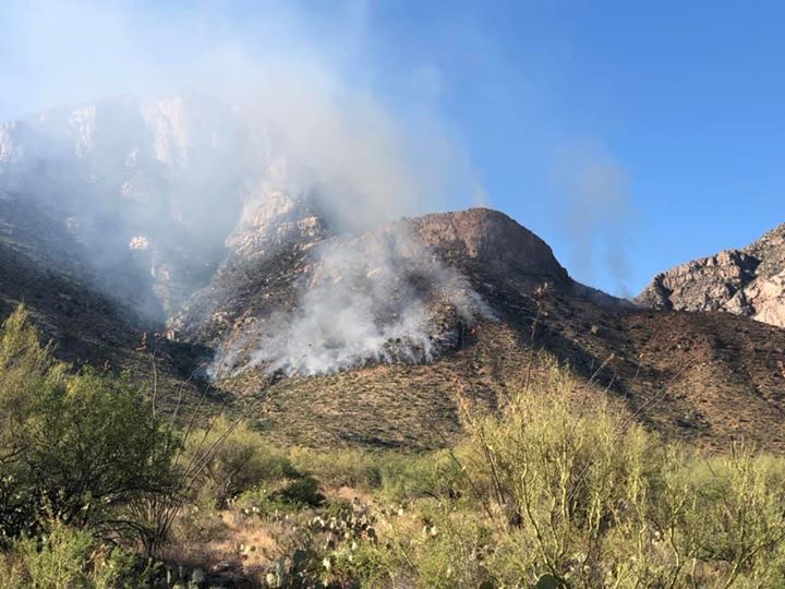
A fire is burning in the Pusch Ridge area east of Oro Valley on Saturday. The fire was started by lightning for storms that moved through Friday night. Ground crews and helicopters are fighting the blaze, which is not spreading rapidly.

Rick Wiley
Photo editor

Rebecca Sasnett
Photojournalist

Kelly Presnell
Photojournalist

Josh Galemore
Photojournalist

Mamta Popat
Photojournalist

Last year was the second-deadliest when it comes to heatstroke deaths for children left in hot vehicles, according to a national nonprofit.

The area known as Miami was first noted for reddish outcrops that enticed prospectors like Black Jack Newman to invest and develop.Т

Walmart cards will be handed out to tribal members in need.

Clinic provides a variety of health service to primarily low income, elderly residents.

УлшжжБВЅ governor imposed nightly curfew May 31 in response to rioting and looting at Scottsdale mall.

The lightning-sparked Bighorn Fire has moved into the upper elevations of Pima Canyon and grown to 2,500 acres since Friday night.

A more experienced management team has assumed command of the Bighorn Fire, which started with a lightning strike Friday in the mountain slopes near Oro Valley, УлшжжБВЅ.Т

Lightning-sparked blaze in the Catalina Mountains has grown to about 3,277 acres as fire crews attempt to box it in before it moves deeper into Pima Canyon.

All hospital workers, other health care workers, corrections officers and state child care workers are now eligible for testing.Т

About 200 homes have been ordered to evacuate immediately in the Catalina Foothills. Hundreds of others could be next.

Community members can buy a $25 gift card for a downtown УлшжжБВЅ business and get a free $10 added on on Friday, June 12.Т

Families with homes near the Bighorn Fire in the Catalina Mountains may take pets to PACC if they can't care for them during evacuations

The Bighorn Fire, sparked by lightning June 5 near Pusch Ridge in the Catalina Mountains north of УлшжжБВЅ, has resulted in evacuations and is being fought by hundreds of wildfire fighters.Т

Crews were conducting back burns near residences in effort to slow spread of the 6,200-acre wildfire.

State gives voters five days to fix, or cure, their ballots if it appears the signature on the envelope does not match what is on file. No such time is granted for unsigned ballots.

UA President Robert Robbins said a possible scenario preventing re-entry in August is if УлшжжБВЅ starts to resemble New York, which saw its intensive-care unit beds and ventilators near capacity during its pandemic peak.

Catalyst Arts & Maker Space gives artists and organizations a place to create and collaborate.

State wildlife official said there have been no confirmed reports of dead animals found in fire. Some wildlife may leave area through established neighborhoods.

The UA has done 11,000 antibody tests since the initiative was launched in April.Т Only 74 people т or about 1.3% т had antibodies, although that rate was slightly higher for health-care workers.

When a stray cat gave birth to kittens, УлшжжБВЅan Ryn Gargulinski knew there was only one thing to do: surrender.

Southern УлшжжБВЅ organizations that once relied on in-person interactions have still been able to offer their services to УлшжжБВЅans in need amid the coronavirus pandemic.

Snippets of life from the Old Pueblo while sheltering in place.

Verse: Proverbs 2:11 т Discretion will keep you; Intelligence will preserve you

I read this poem by Josephine Hart at our Shabbat service last week. I actually read it twice, to be sure it sunk in. More than ever we need t…

Life comes with tests тІ

The Bighorn Fire may have damaged soils near УлшжжБВЅ-area homes, making them vulnerable to debris flows.

Seventeen years ago this week the Aspen Fire devastated the mountaintop community.

Fearing possible ash and debris from the Bighorn Fire, biologists moved about 900 Gila chubs from Sabino Canyon to man-made habitats across the УлшжжБВЅ area.

Stubborn fire in Catalina Mountains north of УлшжжБВЅ has cost $10 million to fight so far.

Heavy use of aircraft has put the firefighting tab at $10 million for the fire in the Catalina Mountains north of УлшжжБВЅ.

Crews are working to link up containment lines north of the fire to protect the communities of Oracle and San Manuel.

Crews were able to keep fast moving fire out of the village of Summerhaven on Mount Lemmon.

The "Black Lives Matter" banner put up to commemorate Juneteenth is visible from the west side of City Hall.

Fire activity also picked Friday around the Ventana and Esperero canyons closer to УлшжжБВЅ.

The ordinance was to be modified to say any enforcement through law enforcement or the courts will be made only with board authority after two supervisors raised concerns about including legal consequences for ignoring the mask-wearing mandate.

Two groups said state refusal to count ballots that have not arrived in the mail by 7 p.m. on Election Day is unconstitutional.

In lawsuit, organization wants judge to order УлшжжБВЅ to begin removing inmates from private facilities.

A 2015 law sharply increased т sometimes by a factor of 30 т the number of signatures needed for Libertarian candidates to qualify for the ballot.
A reader has said he can't find grocery bag recycling bins. Another reader said her store didn't allow her to use her cloth grocery bags even though she had washed them. What gives?

УлшжжБВЅ Unified School District spent $1.2 million on law enforcement in 2018 and 2019,to have school resource officers at schools and off-duty law enforcement at events.Т

The wildfire near УлшжжБВЅ has grown to 58,553 acres and was 16% contained as of Monday, officials said.

Nearly 1,000 people are assigned to the Bighorn Fire, which has cost nearly $20 million so far to fight.

Firefighting efforts today could add to the smoky skies over portions of УлшжжБВЅ and the town of Oracle.

Free event will take place on a first-come, first-serve basis from 7 a.m. to 10 a.m. Thursday at Kino Sports Complex, 2500 E. Ajo Way.

Fireworks aren't the only thing to look forward to for the long Fourth of July Weekend. Go-karting, catching a flick, museum-hopping and indoor playgrounds are among the optionsТ

Country music superstar Garth Brooks to perform a concert on Saturday that will be shown at 300 drive-in movie theaters nationwide including three in УлшжжБВЅ.Т
The wildfire has grown to nearly 82,000 acres and was 33 percent contained Thursday morning. More than 1,000 people are fighting the fire.

The wildfire was at 104,690 acres Sunday morning. It was 45% contained and 1,168 people were assigned to the fire, which has cost more than $28 million to fight so far.

Annual summer camps at the facility had to be canceled because of the fire and COVID-19 pandemic.

Gusty winds Monday made it more difficult for crews fighting the Bighorn Fire as they concentrated on the eastern edge of the blaze where its …

The Bighorn Fire was started by lightning near Pusch Ridge north of УлшжжБВЅ on June 5. It burned for about a month growing to nearly 120,000 acres, about 187 square miles.

The University of УлшжжБВЅ's reassurance to its international students and athletes comes a day after Immigration and Customs Enforcement said those who attend colleges with only online courses in the fall would need to leave the US.

As of Wednesday morning, the Bighorn Fire has reached 78% containment.Т

Pima County has mailed warning letters to more than 400 homeowners living along six washes in the Catalina Foothills and Pusch Ridge areas. A single storm already caused a "scary" ooze of black gunk, ash, tree limbs and brush in one wash there.Т

Free webinars will air for three consecutive Wednesdays on Zoom begining Aug. 5. Each webinar will begin at 6 p.m. УлшжжБВЅ time.
The Bighorn Fire, sparked by lightning June 5 near Pusch Ridge in the Catalina Mountains north of УлшжжБВЅ, has resulted in evacuations and is being fought by hundreds of wildfire fighters.Т

The Bighorn Fire raged north of УлшжжБВЅ for more than a month last year. Experts say it could take three to five years for the area to stabilize.

Watch to the end to see the beginnings of the red fire retardant drop, just as the tanker disappears behind the hill.

The Bighorn Fire, which began June 5, covered about 2,300 acres by midday Monday. It is burning into the upper reaches of Pima Canyon.

Fire crews are currently at the facility near Speedway and Kolb.
Officials are providing more information about the Bighorn Fire.

The Bighorn Fire has burned 8,950 acres since June 5 and is only 10% contained.Т

Strong winds to the southwest today will push the Bighorn Fire to the northeast. Fire crews made headway Friday with threatened areas where advancing flames forced evacuations: near Catalina State Park and along the northern edge of УлшжжБВЅ's Catalina Foothills.
The press conference will start at 2:30 p.m. to update the community about the Bighorn Fire.Т

The area of Mt. Lemmon and Mt. Bigelow just north of Rose Canyon Lake is now in "set" orders, where residents are urged to voluntarily leave or be prepared to evacuate.Т Т

Bighorn Fire update: The fire has grown to 14,675 acres and pushed to the northeast overnight.

The Bighorn Fire burning in the Catalina Mountains north of УлшжжБВЅ was started by lightning on June 5.

"Crews are watching out for erratic winds, as dry thunderstorms are possible over the Santa Catalina Mountains," the Forest Service said.

Monday storms helped to limit the Bighorn Fire's spread. High winds on Tuesday will create a challenge.

Fire crews responded to the fire's movement Tuesday with large airtankers to work the fire's edge and keep it from moving closer to the observatory.Т
The fire has grown to 17,492 acres with 40% contained.

Major fires are burning across the state amid hot, windy and dry conditions.

The Bighorn Fire, now at about 43,000 acres, continued to move down the Santa Catalinas overnight displaying an eerie show of flames and smoke…

The wildfire has grown to nearly 82,000 acres and was 33 percent contained Thursday morning. More than 1,000 people are fighting the fire.

Containment of the lightning-caused blaze has remained steady at 33 percent. Some 1,100 people are assigned to fight the wildfire.

Evacuation orders now in place for Redington residents

Residents in the southern Catalinas between Catalina Highway milepost 3 and Redington Road were given evacuation orders Sunday night due to th…

The Bighorn Fire is now 107,099 acres т more than 168 square miles т and containment is 45 percent.
The wildfire sparked by lightning on June 5, has grown to nearly 115,000 acres т about 179 square miles т and was 45 percent contained.
The Bighorn Fire has grown to 118,370 acres т about 185 square miles т and is 54 percent contained. On Wednesday, 904 people were assigned to fight the fire started by lightning JuneТ 5 near Pusch Ridge.

The wildfire started near Pusch Ridge on June 5 was at 118,710 acres on Thursday morning.

Crews assigned to the Bighorn Fire will continue their clean up work as they move toward significant increases in overall containment over the…

The lightning-caused wildfire in the mountains north of УлшжжБВЅ has been burning since June 5. It has scorchedТ 119,020Т acres.

A lightning storm sparked a wildfire about 14 miles west of Sahuarita Saturday night. The Navarro Fire started around 10 p.m. and has burned about 1,100 acres, according to the УлшжжБВЅ Department of Forestry and Fire Management.Т

The road to Mount Lemmon will remain closed for the foreseeable future as fire crews asses the damage the Bighorn Fire caused. Fire officials warned of the high risk of flash floods with the upcoming Monsoon storms.

The Navarro Fire 14 miles west of Sahuarita, that started Saturday night during a lightning storm, grew to 2,306 acres by Monday.Т The lightning-sparked Bighorn Fire has burned 119,589 acres since June 5.Т

Catalina State Park, which lies outside the forest but has also been closed due to the wildfire, is exempt from the federal closure order and can reopen.

The flash flood warning includes southeast Pinal County, the Catalina and Rincon mountains, Marana, Vail, Mount Lemmon, Summerhaven, УлшжжБВЅ, Mammoth, Oracle and Green Valley.Т

The Pima County Sheriff's Department will monitor the amount of traffic going up the mountain and delays are expected.

The highway from УлшжжБВЅ to Summerhaven was reopened last week after a closure prompted by the massive Bighorn Fire. But the Coronado National Forest on Mount Lemmon remains closed to the general public.

The Westridge Fire, in the Tortolita Mountains northwest of УлшжжБВЅ near Marana and Oro Valley, stood at 480 acres on Tuesday.

But starting Saturday, Aug. 29, the bad air should get better as clouds roll in to the УлшжжБВЅ area and temperatures fall below the century mark, the weather service says.