

In 1911, amateur ornithologist Frank Willard marveled at the huge mesquite trees dominating the Santa Cruz River banks near what is now San Xavier Road south of УлшжжБВЅ:
тThe mesquite trees are wonders of their kind. тІ There were some whose trunks at the base scaled over four feet in diameter. The large bases branched a few feet into several limbs 15 or 18 inches in diameter,т Willard was quoted in the book, тRequiem for the Santa Cruz.т
For many decades, this mesquite bosque, covering seven square miles, was a mecca for bird lovers and scientists. From 60 to more than 70 bird species were known to have bred there at various times from the turn of the 20th century until the 1940s, and well over 100 species total lived there. The bosque helped make the УлшжжБВЅ area one of the ornithological capitals of the Southwest.
But the introduction of large-scale groundwater pumping in the 1920s and onward, coupled with widespread tree-cutting for firewood and power supplies, destroyed the bosque by the 1960s, said the Santa Cruz book, written by four longtime УлшжжБВЅ-area scientists.
People are also reading…
Now, with perennial water flowing once again on the Santa Cruz at San Xavier Road, and small cottonwood shoots starting to reappear, will this bosque come back?
The most likely answer is that something significant and possibly exciting will return. But itтs not certain if it will be a replica of the historic bosque, several experts told the УлшжжБВЅ, or how long any restoration will take.
One expert, 87-year-old riparian ecologist Roy Johnson, who studied birds there in the late 1950s, admitted, тI just donтt know. I canтt think of any other place that Iтve seen that happen to make a prediction. I donтt know of another case I could look at as a model.т
This will be a new ecosystem, and it is anyoneтs guess how it will develop, said retired hydrologist Robert Webb, who with Johnson co-authored the 2014 тRequiemт book along with Julio Betancourt and Ray Turner.
Another uncertainty is that right now, тwe really donтt know where the groundwater is coming fromт that is supplying water to the aquifer under the river, Webb said. While the sources of the water recharging the aquifer are known, their relative contributions arenтt clear. Learning that тwould require a major groundwater study,т Webb said.
The Great Mesquite Forest, as it was called, wonтt return exactly as it was, said Eric Holler, a retired U.S. Bureau of Reclamation engineer involved in Santa Cruz River management issues for a quarter-century.
Thatтs because of a wide variety of societal changes in the УлшжжБВЅ area including suburbanization and industrialization, and because of several different actions at play today involving groundwater use and recharge in that area, he said.
But if the groundwater levels keep rising, Webb said, тit will be amazing. Because in the desert, just add water and Mother Nature will take care of the rest.т

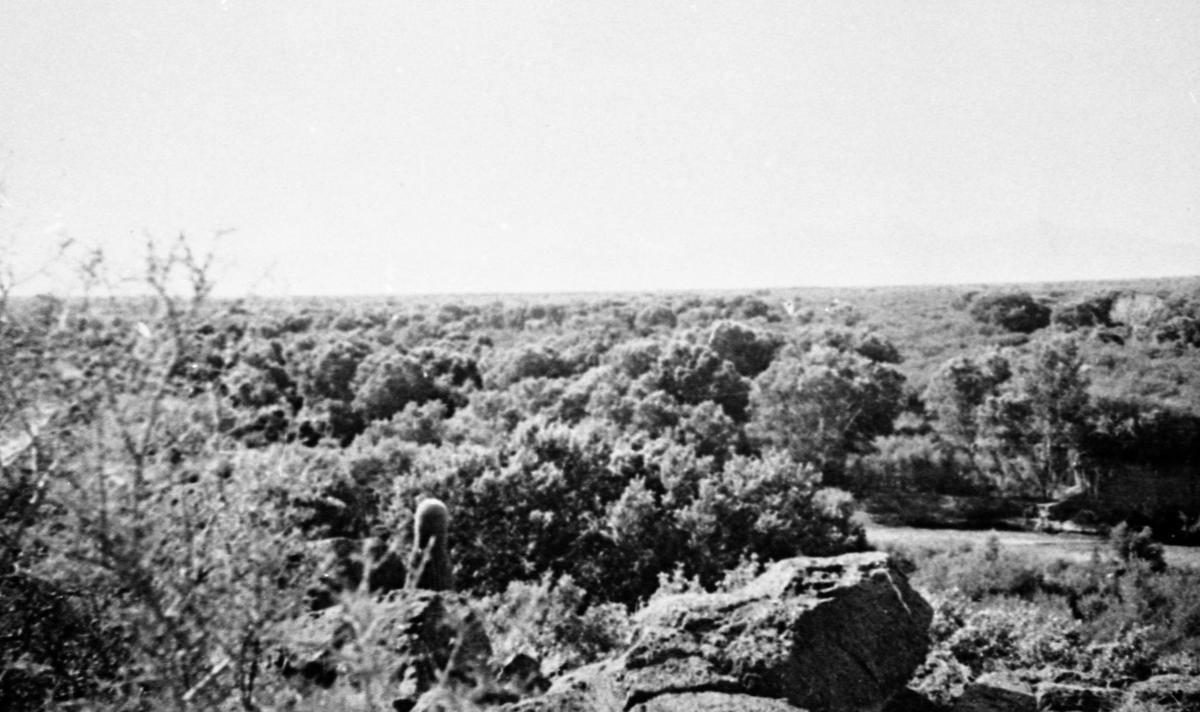
In this 1978 photo looking south on the Santa Cruz River from about three-quarters of mile east of Mission San Xavier del Bac, the mesquite forest is nearly gone.
тThe most picturesqueт
The mesquite bosque itself lay just east of whatтs now considered the San Xavier area of the Tohono OтOdham reservation. It was sandwiched between the saguaro-packed Martinez Hill east of the river and Black Mountain to the riverтs west.
It got early, major notices from Western explorers, travelers and military officials in the middle of the 19th century.
In 1846 during the Mexican War, U.S. Army Lt. Col. Philip St. George Cooke found the mesquite grove near San Xavier so thick that he feared it would provide enemy troops cover for an ambush, wrote УлшжжБВЅ archaeologist Deni Seymour in an unpublished paper on the riverтs environmental history.
John Russell Bartlett, an artist, historian and U.S.-Mexican boundary commissioner, rested at the forest in the 1850s and called this area of the Santa Cruz valley тthe most picturesque and beautiful we had seen,т says the тRequiemт book.
For the San Xavier people living near the river, the mesquite bosque, along with canopies of cottonwood, willow, hackberry and walnut trees, provided shade, resources and a sense of place, Seymourтs paper said.
By the early 1900s, what was then called the Great Mesquite Forest had become one of the Southwestтs best studied places for birds, the тRequiemт book said. By 1936, aerial photos showed it extended 6.75 linear miles.
In 1917, scientist William Dawson led a party of five scientists into the bosque and reported, тthe humble mesquite тІ rises here to the dignity of a real tree, matchless for size and extent, (and) contained trees sixty and seventy feet in height and up to three feet in diameter,т the тRequiemт book says.
Ornithologist A.C. Bent came there a few years later and reported, тthe forest was rich in bird life and the air was filled with their music.т
I-19 construction was death knell
The forest started to decline in the 1930s and т40s, first from woodcutting that knocked over some trees towering more than 65 feet high, the book said. The trees grew back but at 15 to 20 feet tall.
Groundwater pumping then lowered the water table under the bosque, by nearly 30 feet from 1930 to 1940 alone, the book said.
Yet by 1958, when ecologist Johnson spent the first of three years in the forest as a University of УлшжжБВЅ zoology graduate student, the forest still teemed with birds, even with the bosque spanning one-third of its original size.
Water was gone from the river but the water table remained high enough to support mesquites with roots 60 feet underground.

Aerial of Nogales Freeway or тCamino de los Padresт under construction on Aug 12, 1968. Photo is looking south from the Valencia Road interchange. Itтs now known as Interstate 19.
Johnson was a masterтs degree student working under Professor Joe Marshall, a co-author of the pioneering тBirds of УлшжжБВЅт book and a student of the forest himself back in the 1930s.
тIt was very thick, when you got in there, you could hardly see more than 50 feet. It was the biggest place for birds I think Iтve ever seen тcertainly in the U.S. and maybe some places in the tropics,т Johnson said.
And, тyou had insects galore in the forestт providing bird food, he said.
The death knell for the forest came first when the state built Interstate 19 through the area in the early 1960s, drawing more people and industry, he said.
тI donтt know, with the city of УлшжжБВЅ growing like it did, it couldnтt be helped,т Johnson recalled. тIt was, so to speak, progress.т
Whatтs next?
Today, even with cottonwood shoots, cattails and sunflower plants back in the river, it will take тdecadesт of sustained recharge of the aquifer to re-elevate the water table to levels that sustained the entire mesquite bosque, said Julie Stromberg. She is a retired УлшжжБВЅ State University life sciences professor and riparian ecologist.
While the water table is even with the river in spots, itтs still up to 100 or more feet deep away from the banks where the bosque once stood.
The riparian vegetation is extending itself up and down river, but not yet laterally alongside it, she said, noting that the mesquite forest back in 1951 was five miles wide.
тThis is not to say that we shouldnтt try! Better now than later or never!т Stromberg added in an email to the Star.

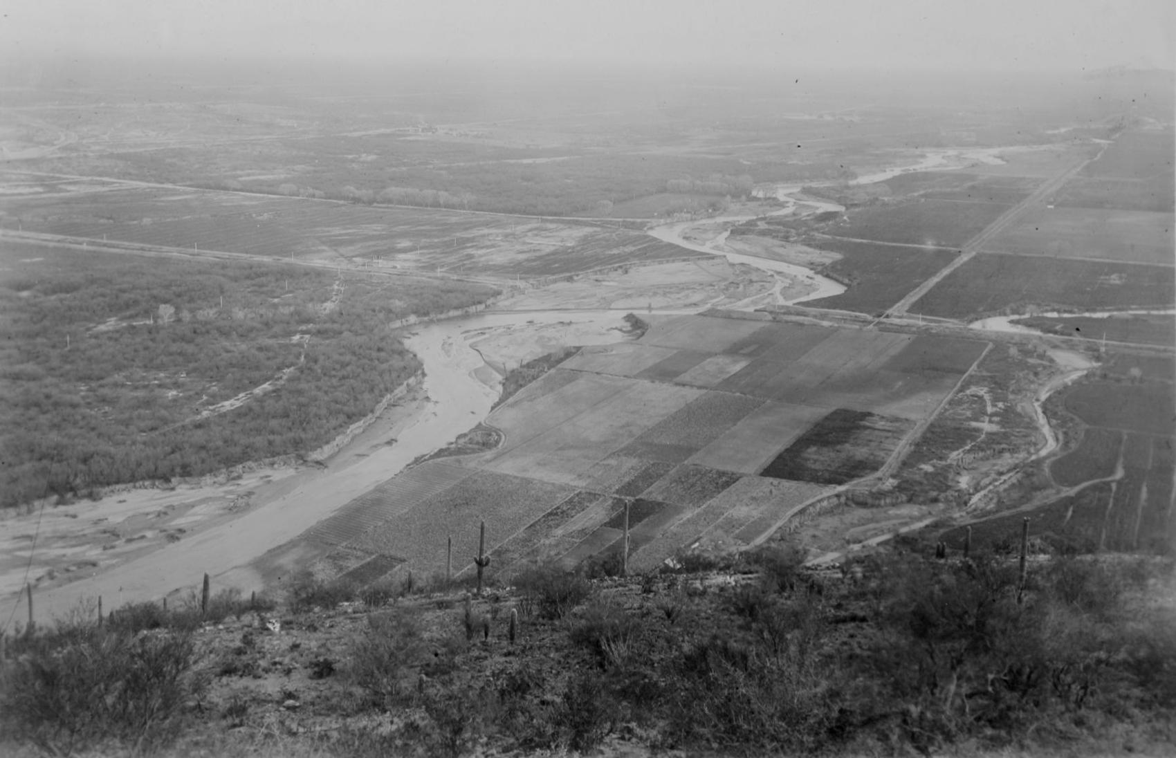
Looking south over the Santa Cruz River from I-19 just south of San Xavier Road on June 18 this year. With water flowing once again, small cottonwoods are starting to appear.
Hydrologist Webb said, тWe will not restore the Great Mesquite Forest. What weтll get is something new and different and quite possibly very exciting.т
One reason that the forest wonтt become a replica of its past glory is that today, the river is both wider and deeper than it used to be, restraining potential future plant growth, he said.
тSecond, the climate is different now, warmer and in some years at least drier,т he said.
Former reclamation official Holler is more optimistic. Today, he notes, the aquifer in and around San Xavier is being replenished due to reduced pumping and more Central УлшжжБВЅ Project water use to the riverтs west, east and south.
Over the long term, water levels will rise to uniform levels and reach equilibrium compared to whatтs being pumped out, he said.
River restoration work could help, along with the building of flood control structures, he said.
Eventually, he said, тwe can expect a lush and abundant mix of mesquite, cottonwood and willow vegetation.т
30+ historic photos of the Santa Cruz River through УлшжжБВЅ
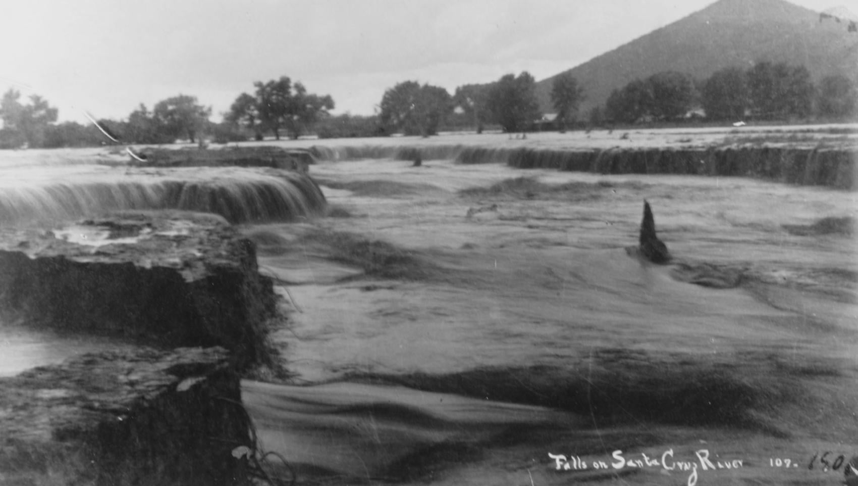
Waterfalls on the Santa Cruz River in 1889 near Sentinel Peak in УлшжжБВЅ.

Girls in Santa Cruz River,1889-1890.
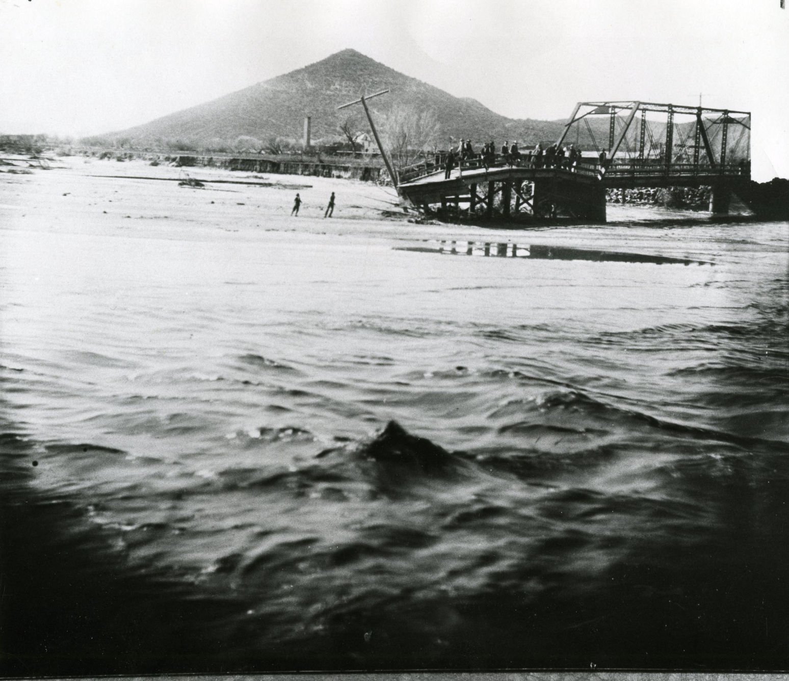
A bridge over the Santa Cruz River near Sentinel Peak in УлшжжБВЅ washed out during flooding in 1915.
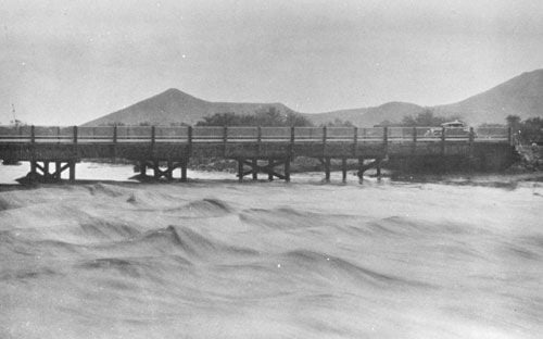
Santa Cruz River at St. Mary's Road bridge in 1931.
The Santa Cruz River flows north as seen from Sentinel Peak in УлшжжБВЅ in the early 1900's.
El Convento along the Santa Cruz River, ca. 1910.
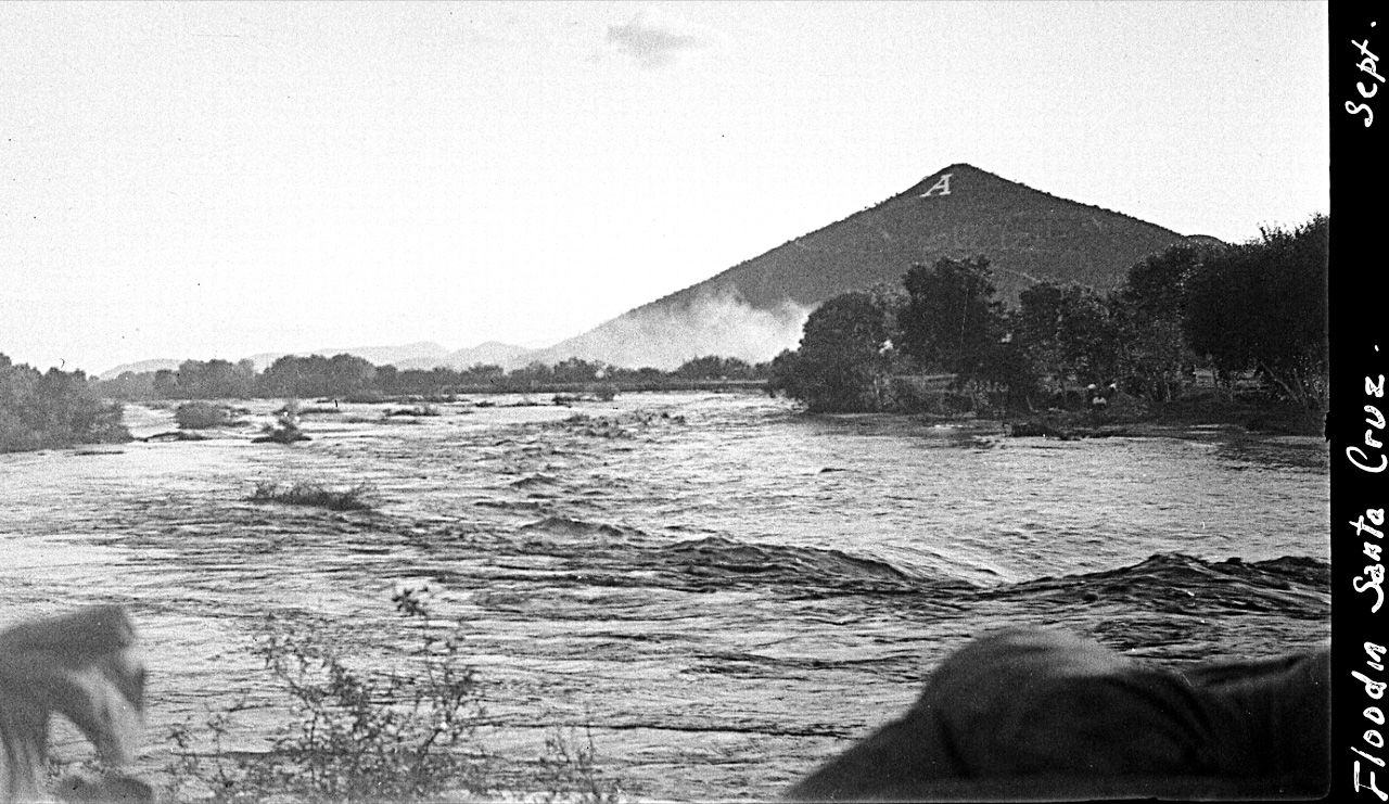
Flooding of the Santa Cruz River, УлшжжБВЅ, in September, 1926, from тLetters from УлшжжБВЅ, 1925-1927т by Ethel Stiffler.
Flooding of the Santa Cruz River, УлшжжБВЅ, in September, 1926, from тLetters from УлшжжБВЅ, 1925-1927т by Ethel Stiffler.

Aerial view of the Santa Cruz River as it winds its way through Pima County north of Cortaro Road in 1953. The county was considering a bridge at several locations, but had to contend with the ever-changing course of the river.

The УлшжжБВЅ Citizen wrote in 1970, "The Santa Cruz River is a garbage dump" and "even marijuana grows in it." City leaders were pushing to upgrade and beautify the channel. The U.S. Army Corps of Engineers was studying the possibility.
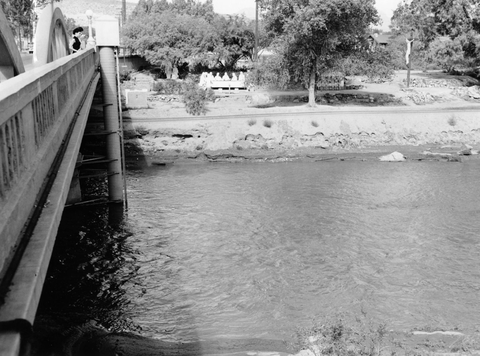
The Santa Cruz River flowing under the Congress Street bridge in August, 1952. The Garden of Gesthemane is in the background.
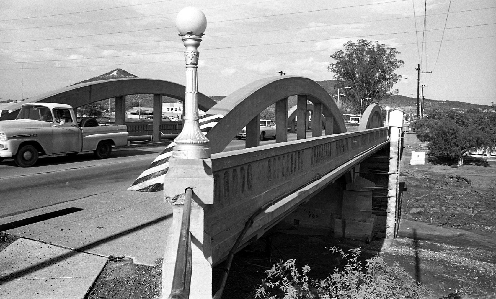
By July 24, 1970 the old bridge on West Congress over the Santa Cruz River had to go and be replaced by a new bridge.

By July 24, 1970 the figures from Felix Lucero's Last Supper had been on the west side of the Santa Cruz River for more than 20 years. City authorities had decided to leave it in place while a new bridge on West Congress Street was to be replaced.
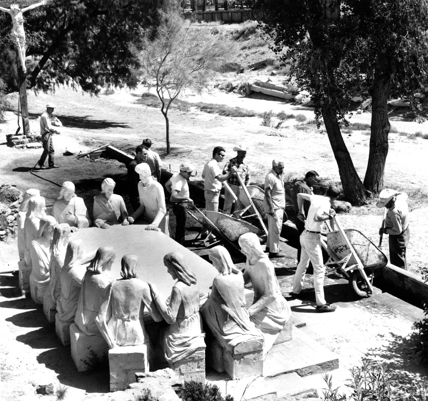
Volunteers from the УлшжжБВЅ Jaycees and Junior Chamber of Commerce finish restoration of the statues and grounds of the Garden of Gethsemane along the Santa Cruz River in May, 1964. The statues were ravaged by vandals and weather. The city parks and recreation department worked with the volunteers. Artist Felix Lucero began sculpture project in 1938 and finished it nine years later.

Drought in June, 1974, turned the Santa Cruz riverbed into crunchy chunks of dried mud.

The Santa Cruz River flowing under Silverlake Road in August, 1970.

Children play in the Santa Cruz River near Speedway Blvd in August, 1970.
The Santa Cruz riverbed at Congress Street in November, 1967.

After years of waiting, crews began clearing debris and channeling the Santa Cruz River in November, 1977, and constructing what would become a 14-mile river park. The Speedway Blvd. bridge is in the background.

After years of waiting, crews began clearing debris and channeling the Santa Cruz River in November, 1977, and constructing what would become a 14-mile river park.

The Santa Cruz River looks peaceful flowing underneath Speedway Road after days of flooding in October, 1977.

Adalberto Ballesteros rides along the Santa Cruz River west of downtown УлшжжБВЅ in 1980.

The Santa Cruz River looking north from Valencia Road in July, 1974.

Junked cars and trash spill into the Santa Cruz River, looking south, just south of Grant Road in July, 1974.

Road graders scrape the Santa Cruz River channel between Speedway and Grant roads during bank stabilization construction in May, 1991.
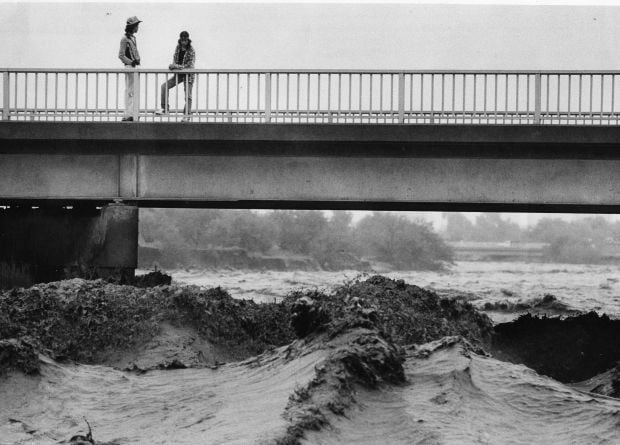
Water surges in the Santa Cruz River at the St. Maryтs Road bridge on Oct. 2, 1983.

Flooding in Marana after the Santa Cruz River overflowed its banks in Oct. 1983.

A bridge on the Santa Cruz River northwest of УлшжжБВЅ washed out during flooding in October 1983.

Residents watch the surging Santa Cruz River rush past West St. Mary's Road on January 19, 1993.Т

УлшжжБВЅ firefighters are standing by and waiting for two kids floating in the Santa Cruz River on some type of object during flooding in July, 1996.

As the УлшжжБВЅ Modern Streetcar rumbles across the Luis G. Gutierrez Bridge, water flows bank to bank along the Santa Cruz River after a morning monsoon storm on July 15, 2014.

Johnny Dearmore skips a rock in the Santa Cruz River as reclaimed water is released into the channel at 29th Street as part of the Santa Cruz River Heritage Project on June 24, 2019. The release of effluent is the cityтs first effort to restore a fraction of the riverтs flow since groundwater pumping dried it up in the 1940s.

The Santa Cruz River flows Friday morning July 23, 2021 after an overnight monsoon storm passed over in УлшжжБВЅ, Ariz.

Betsy Grube, center, with УлшжжБВЅ Game and Fish Department, releases longfin dace fish into the Santa Cruz River at Starr Pass Boulevard on March 23, 2022, as Mark Hart, right, takes a video and Michael Bogan, a professor in aquatic ecology at the University of УлшжжБВЅ, picks up more fish to release. The 600 fish were captured from Cienega Creek in Vail.
Contact reporter Tony Davis at tdavis@tucson.com or 806-7746. On Twitter@tonydavis987

Tony Davis
Reporter


